 |
|
Kane County, Illinois
History and Genealogy Welcome
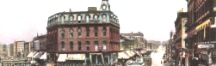
to Kane County ILGenWeb Kane County was organized on January 16, 1836. It was named after Territorial Judge Elias Kent Kane. The new Kane County included DeKalb County and part of northern of Kendall County. DeKalb separated from Kane County in 1837, and Kendall in 1841. Some of the earliest settlers were Joseph and Samuel McCarty, Hezekiah and James T. Gifford, and Christopher Payne. Read about early Kane County life - click here for access. This
county is adoptable. Pat Sabin, was the previous County Coordinator for Kane County ILGenWeb. She had been an active contributor to The USGenWeb Project since 1996, and a County Coordinator since 1999. Your volunteer participation is welcome! Read more ABOUT the USGenWeb Project and ILGenWeb Project, and visit the VOLUNTEER page to see how you can contribute. Thanks to Marcia Holpuch, for her dedicated service as Kane County ILGenWeb Coordinator, 1998-2007, and to all the contributors who made this site such a great resource for Kane County genealogists. The USGenWeb Project is an all volunteer organization. Hopefully we have included ample information here to assist you in your search. |
| search engine by freefind | advanced |
|
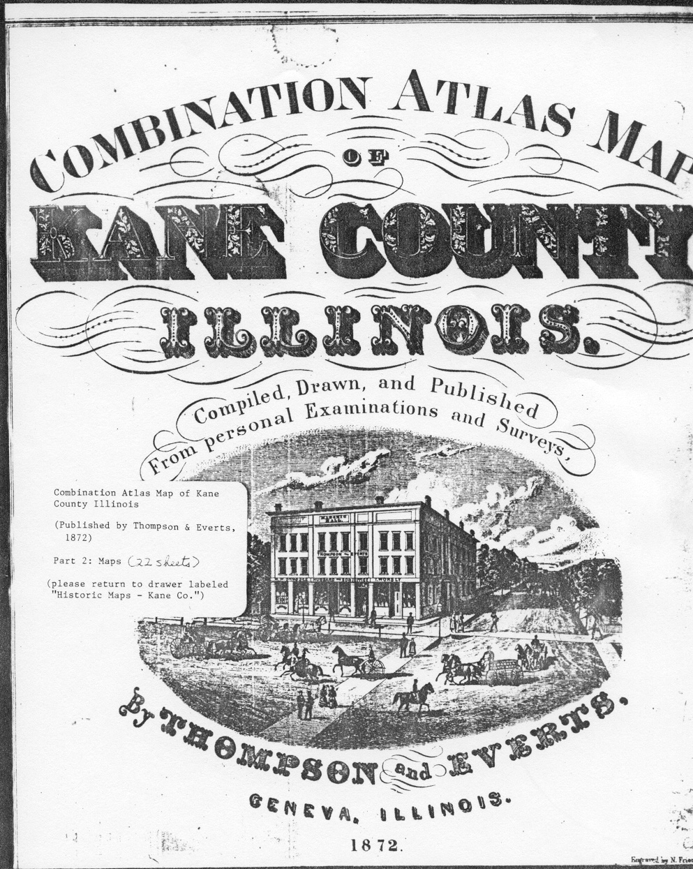
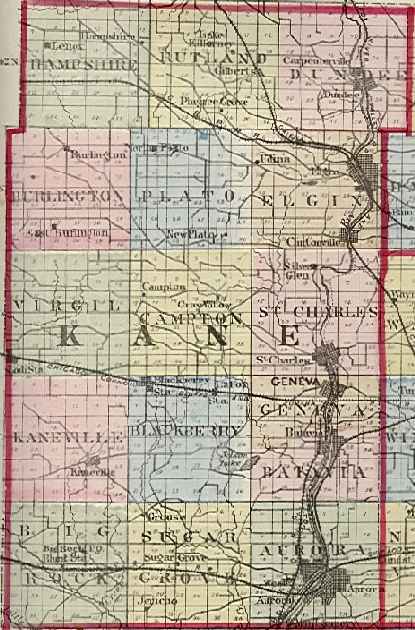
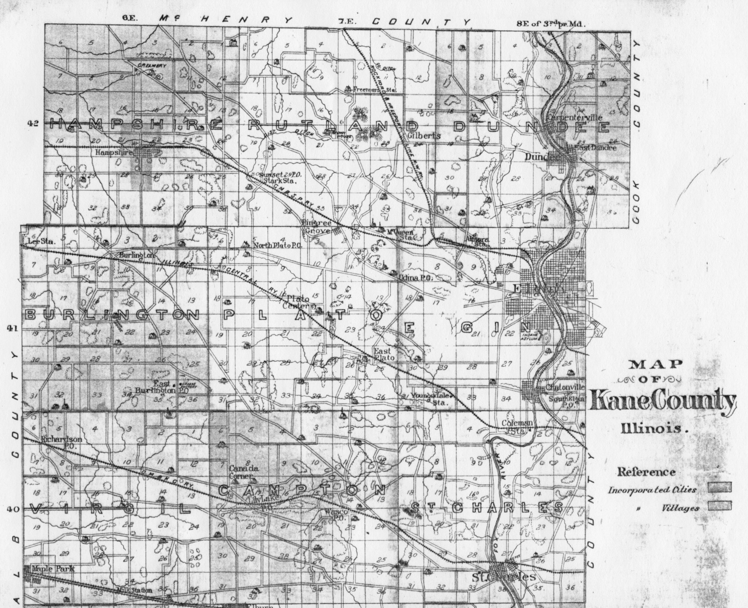
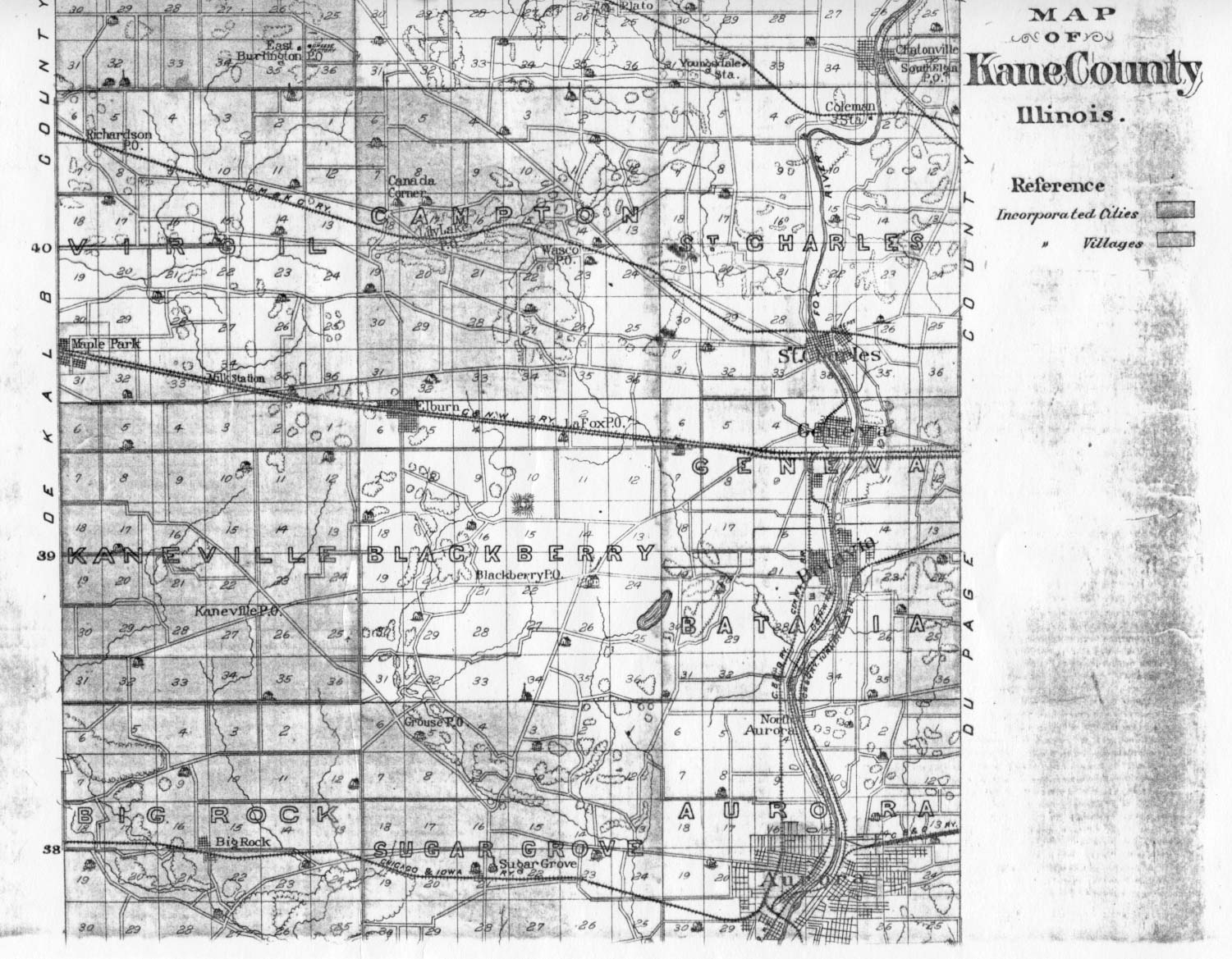
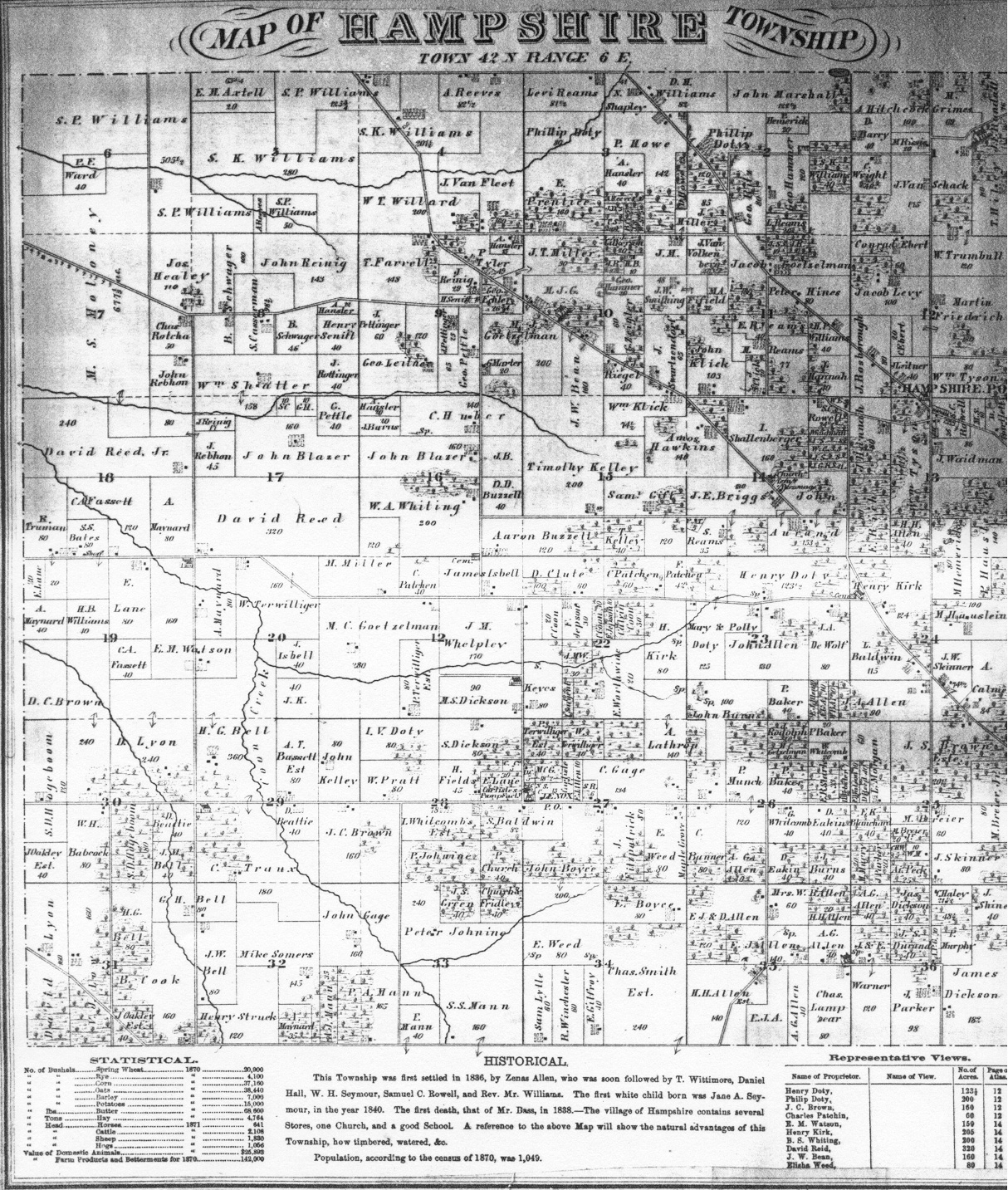
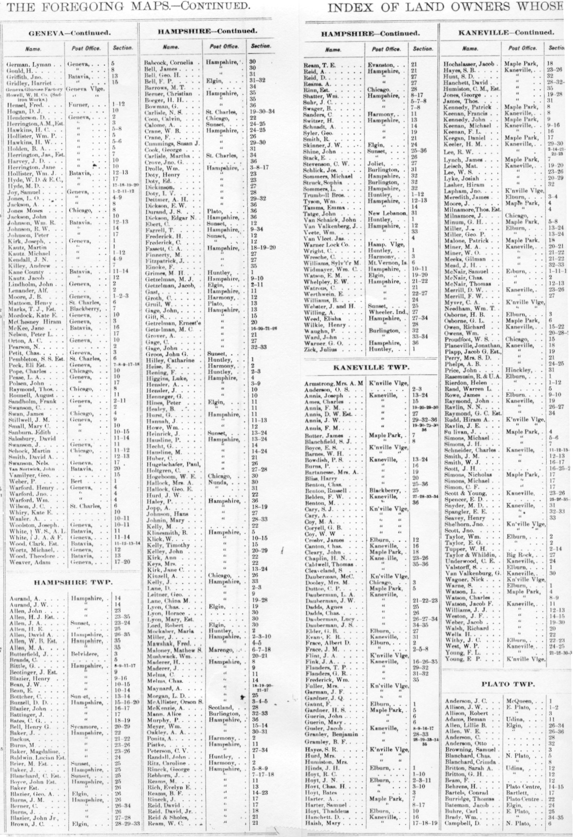
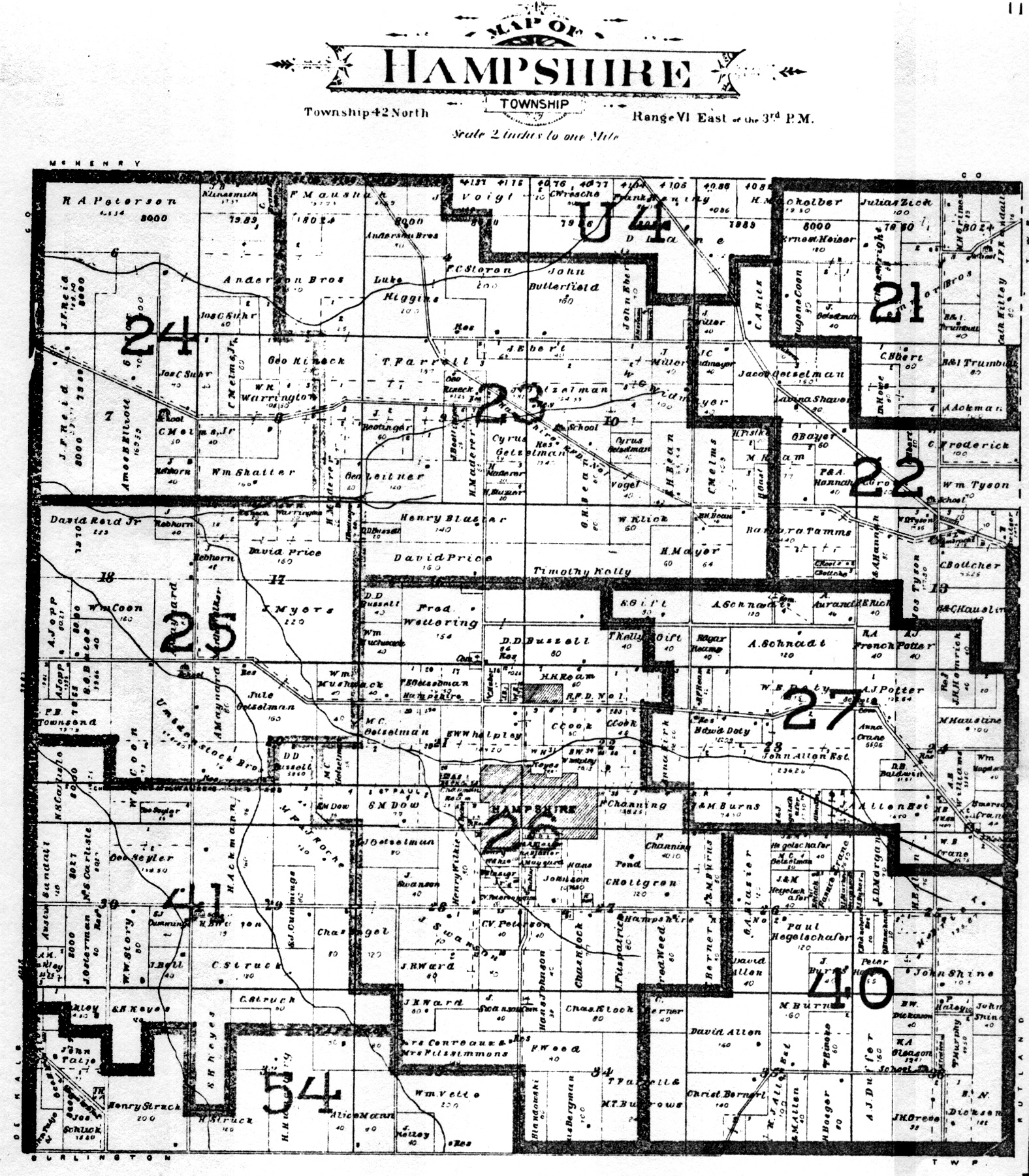
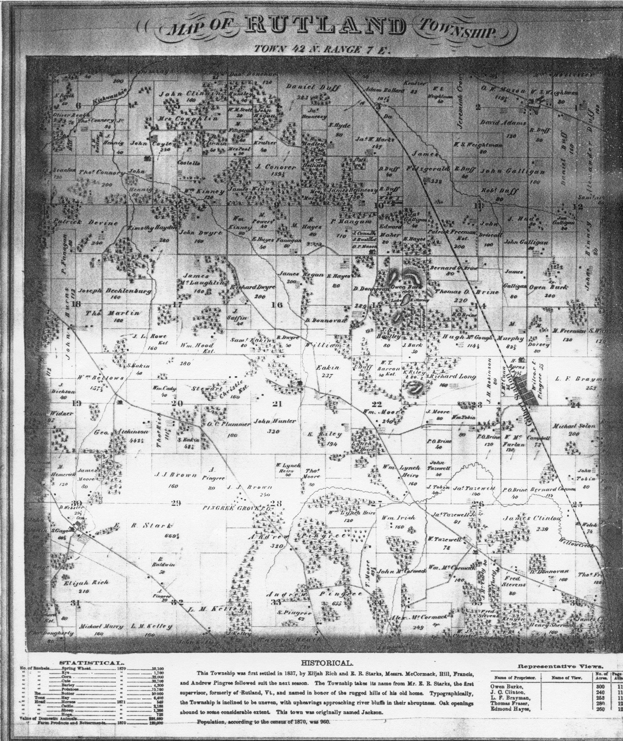
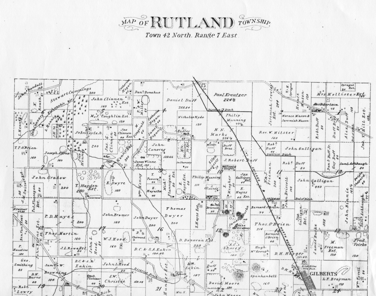
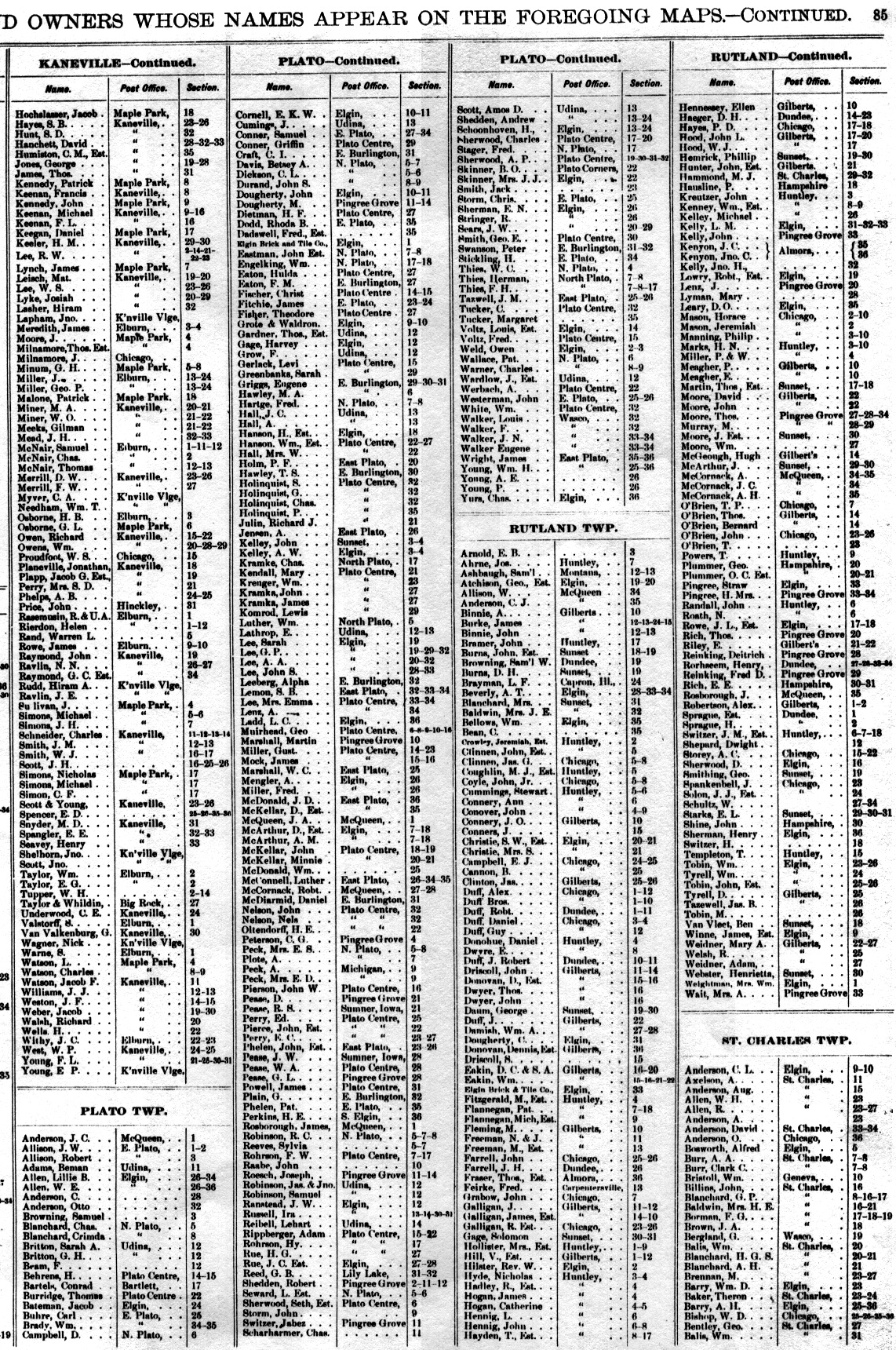
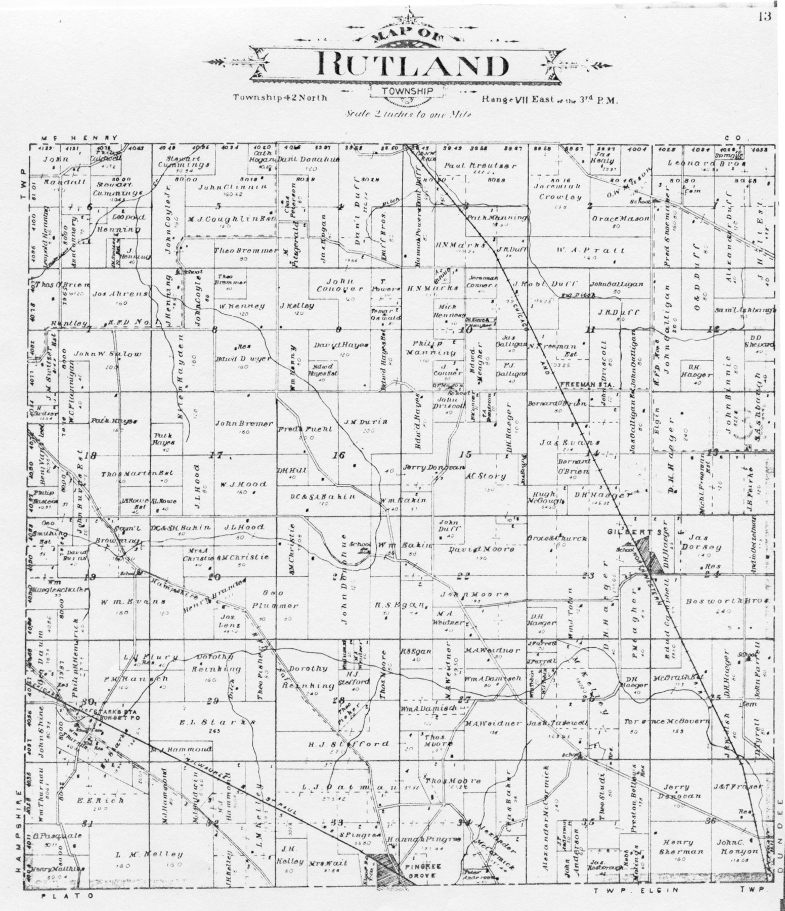
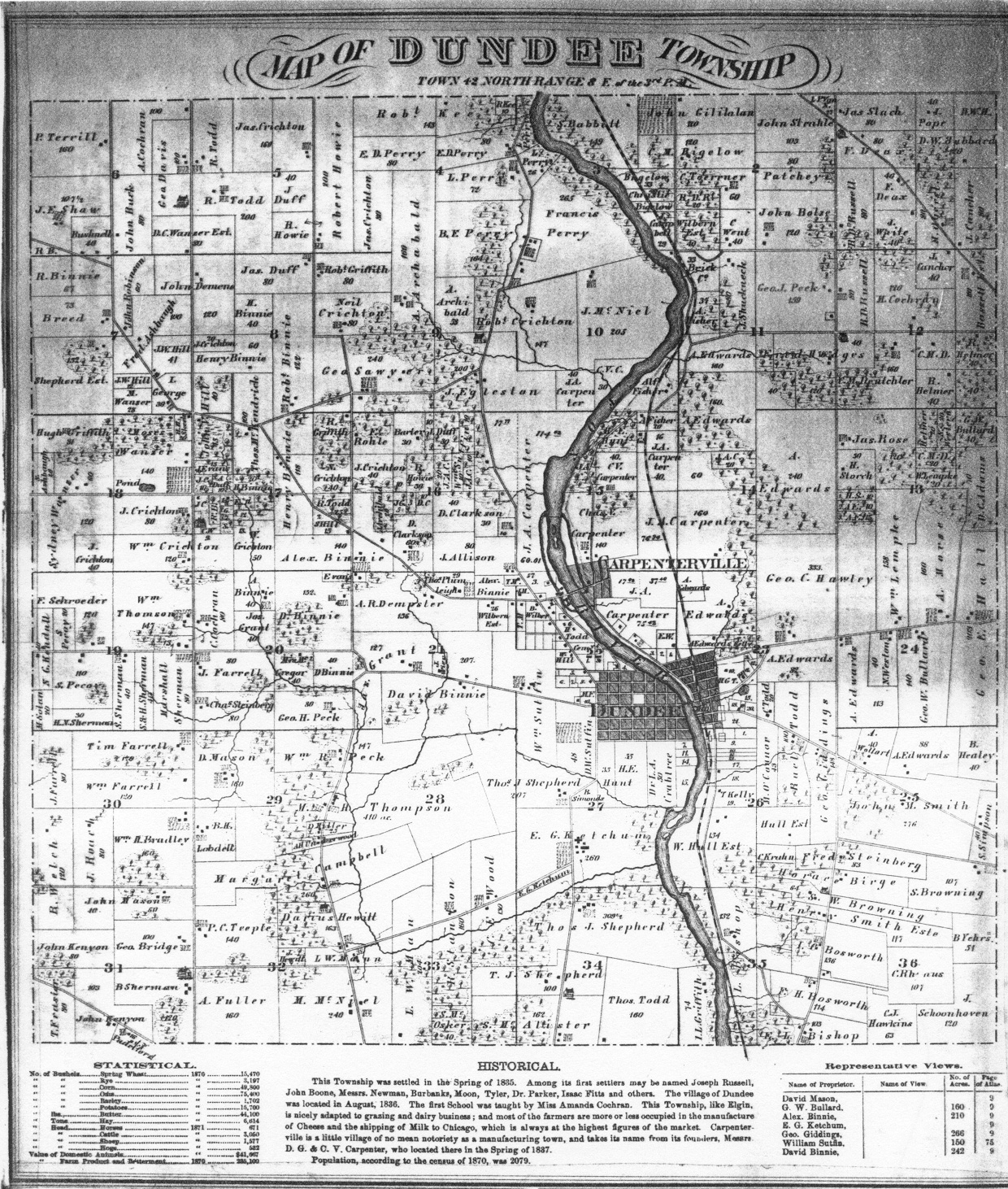
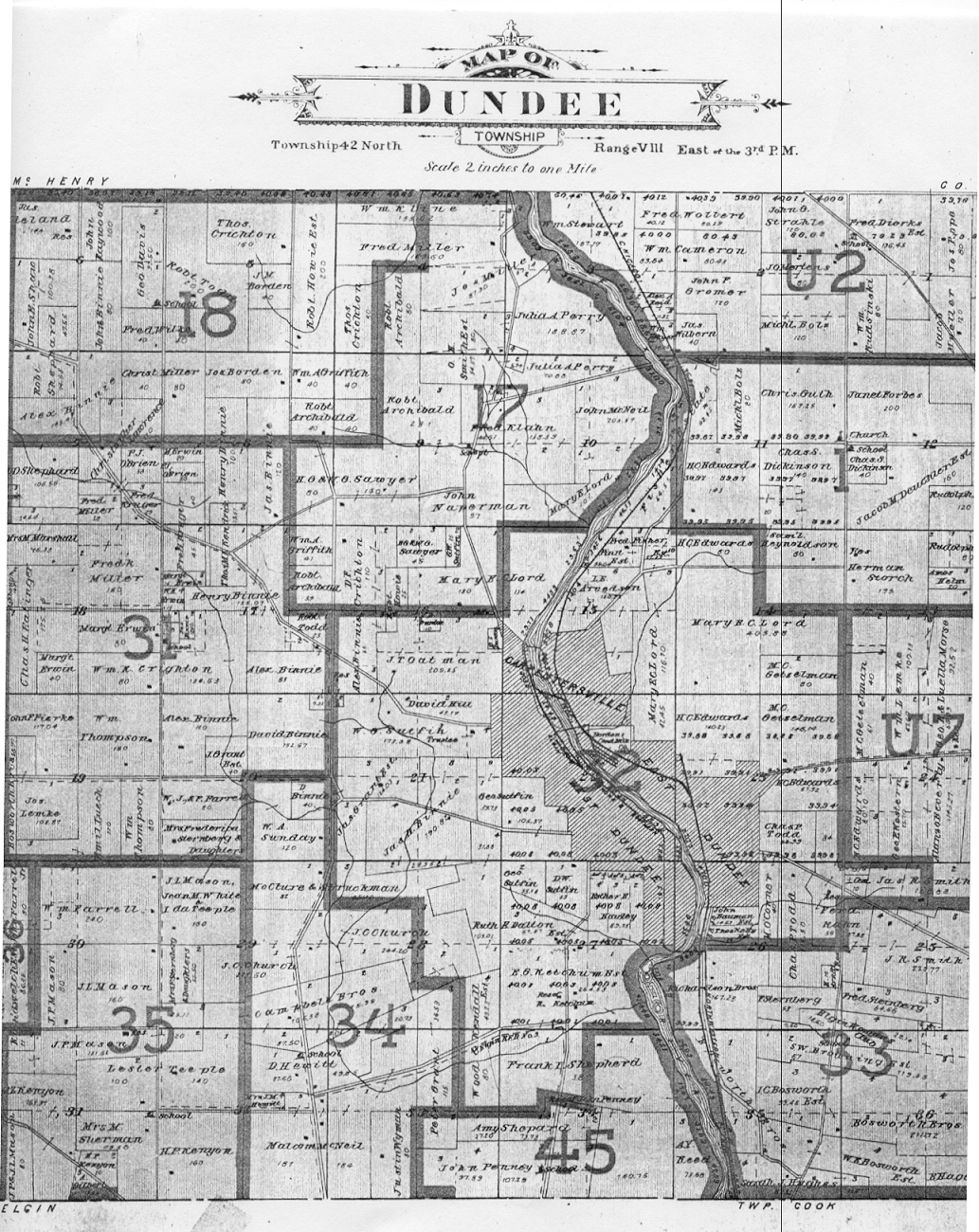
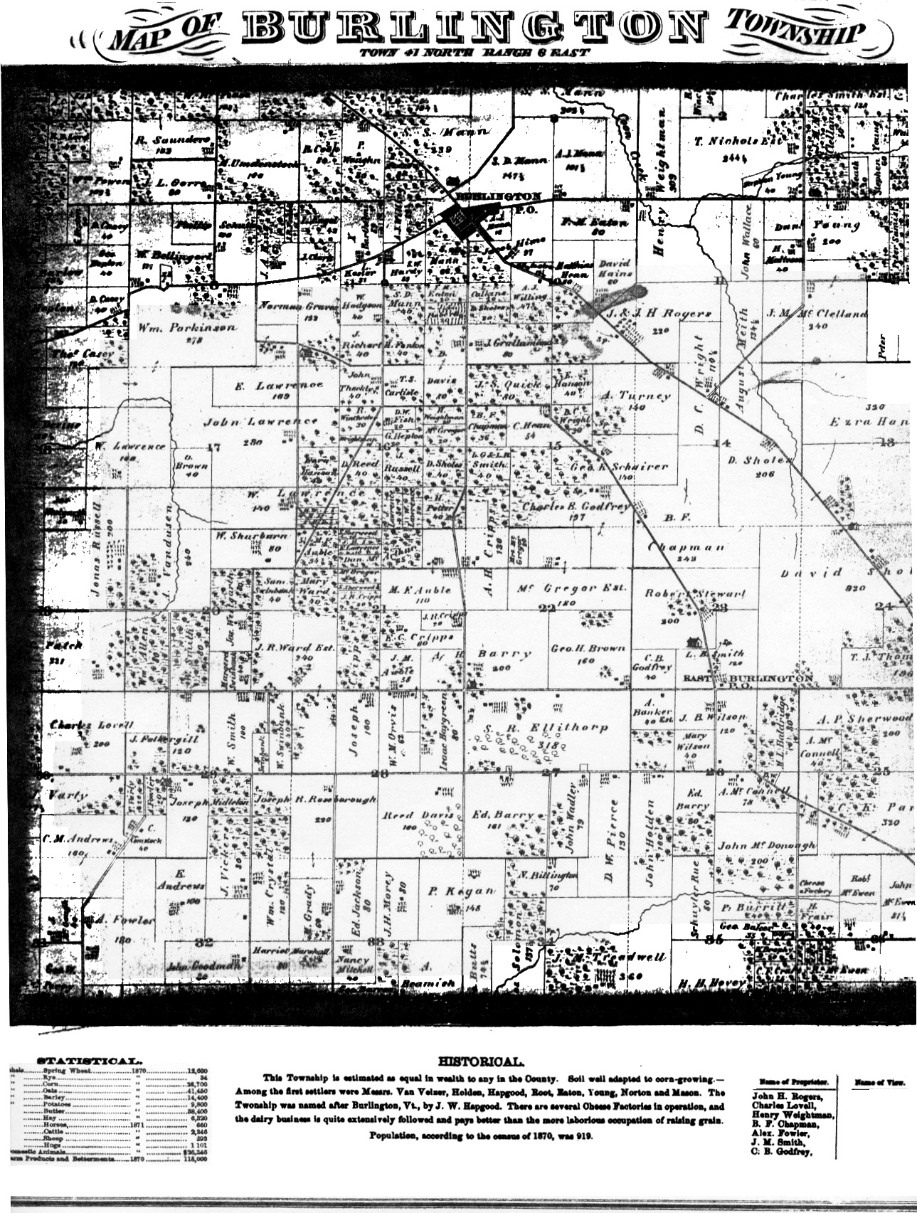
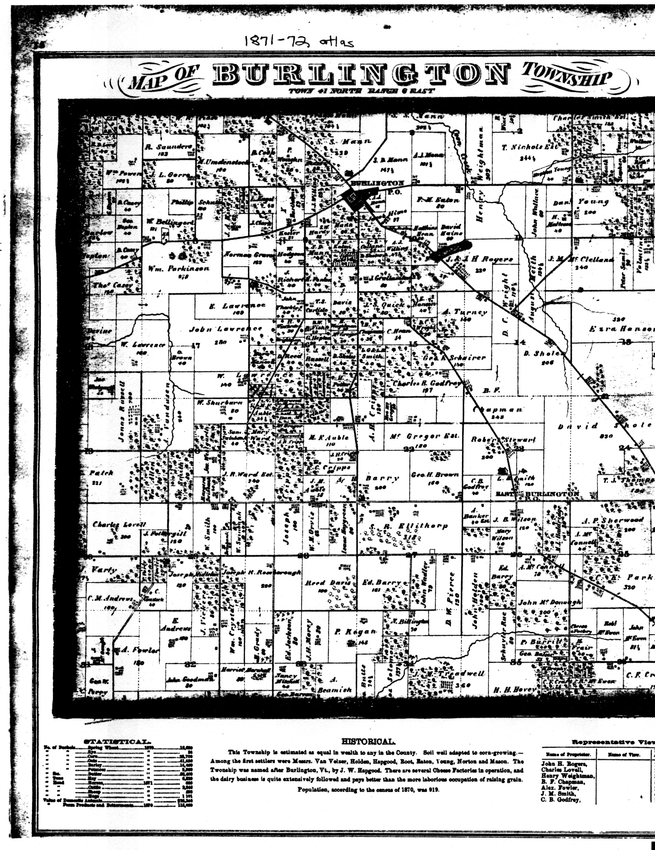
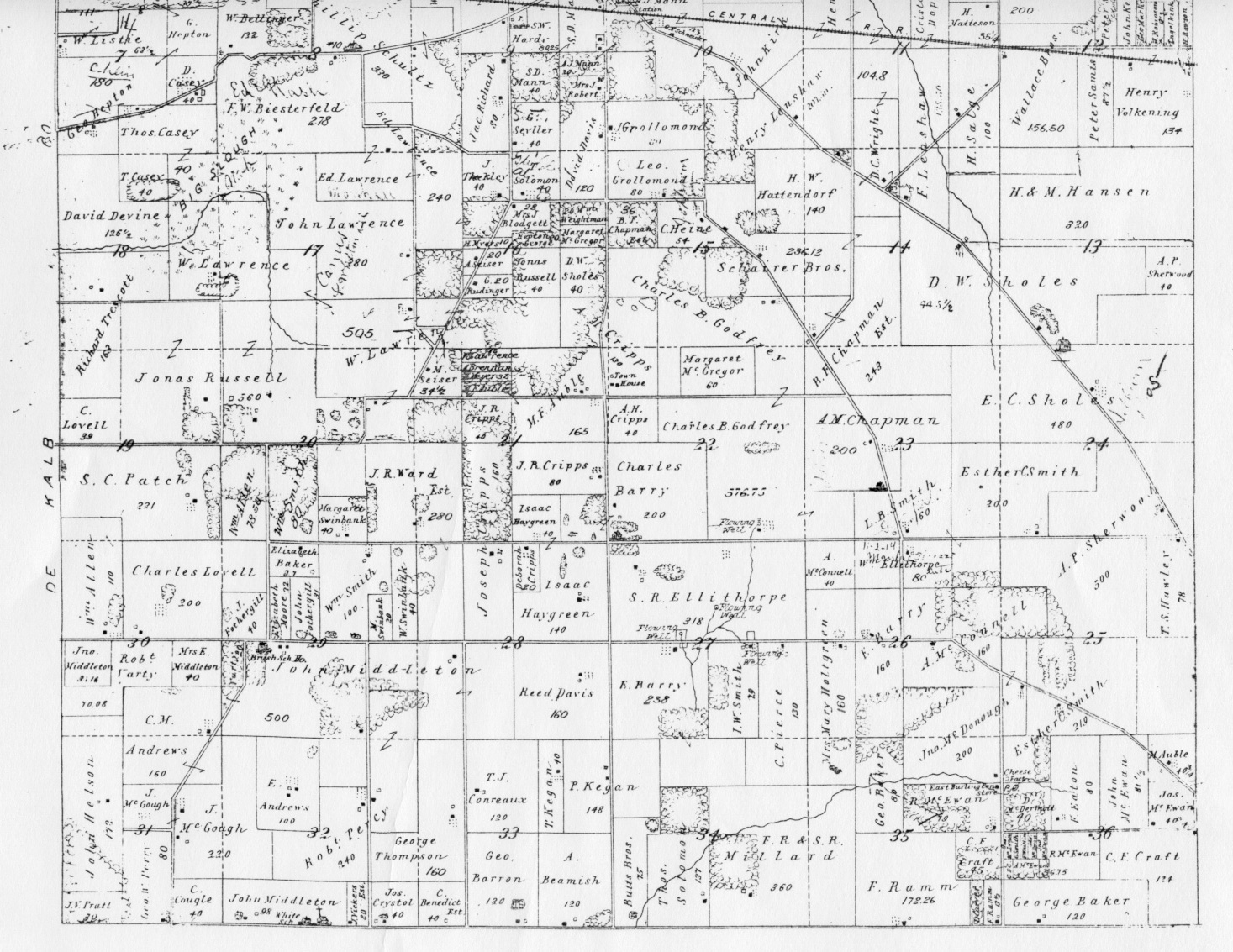
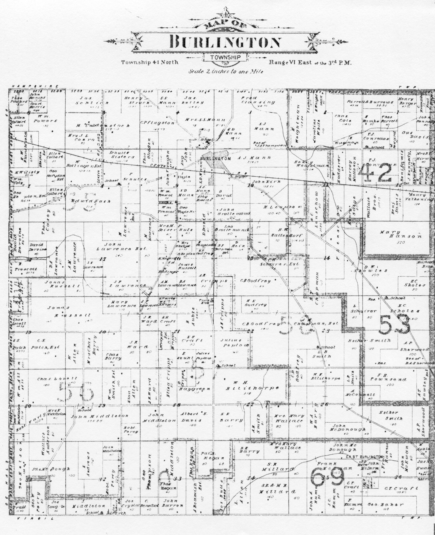
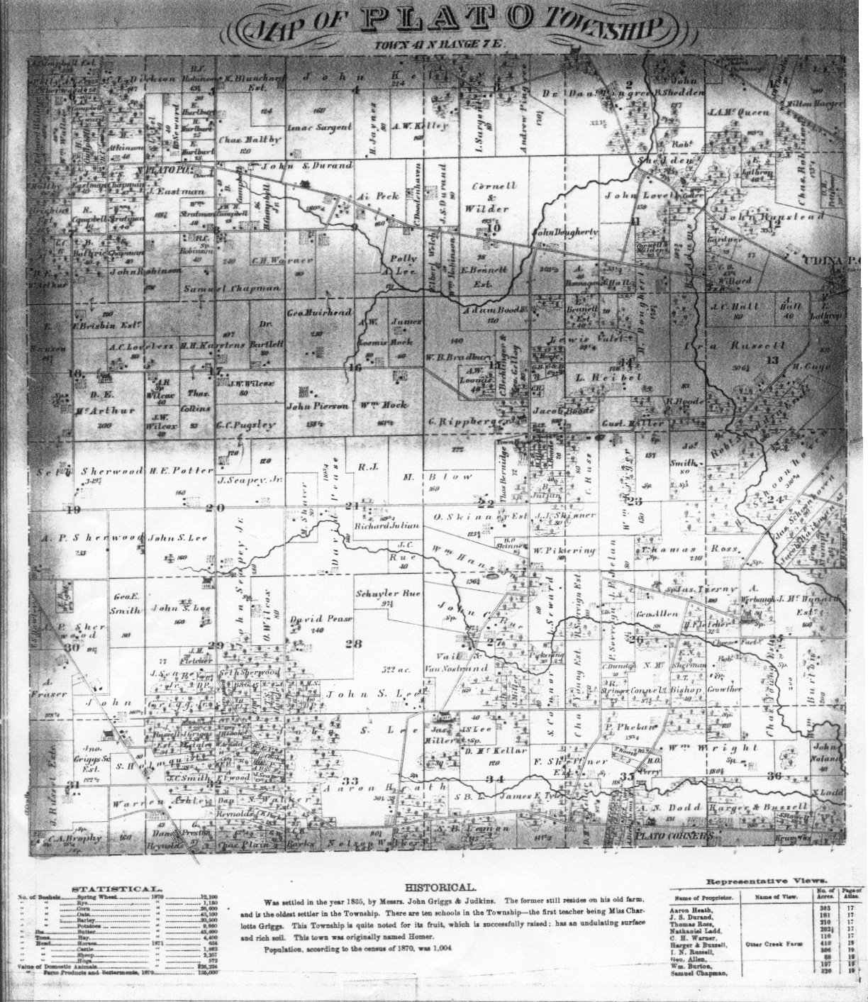
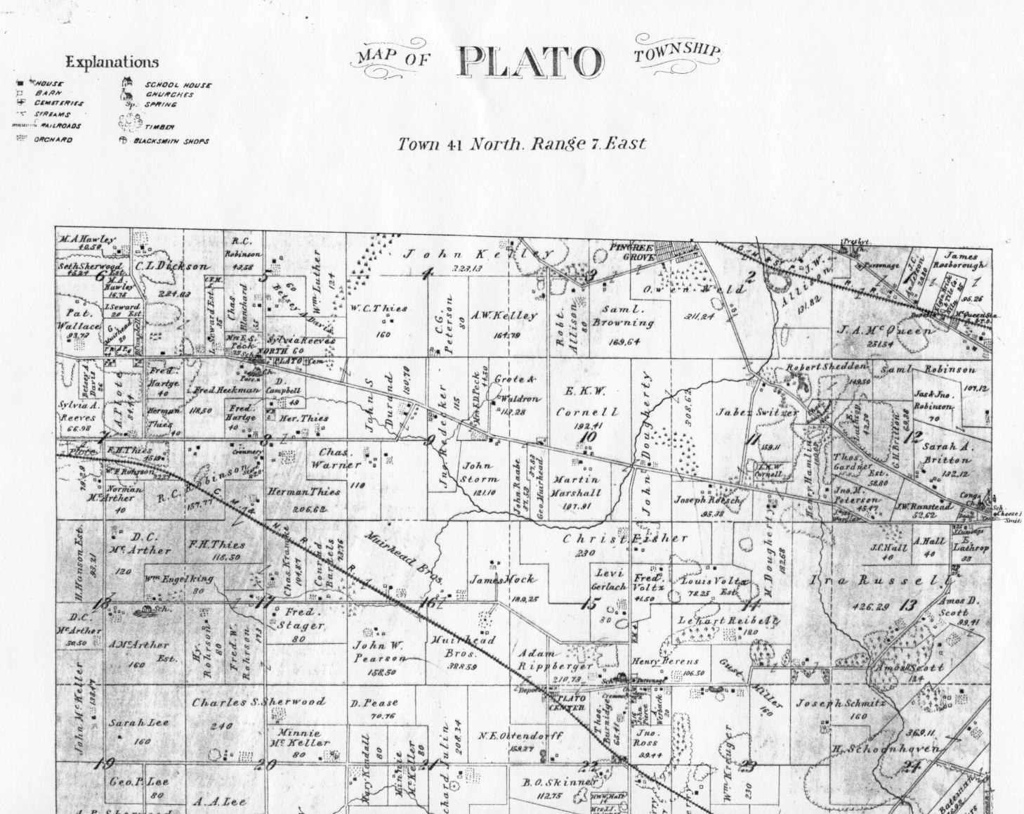
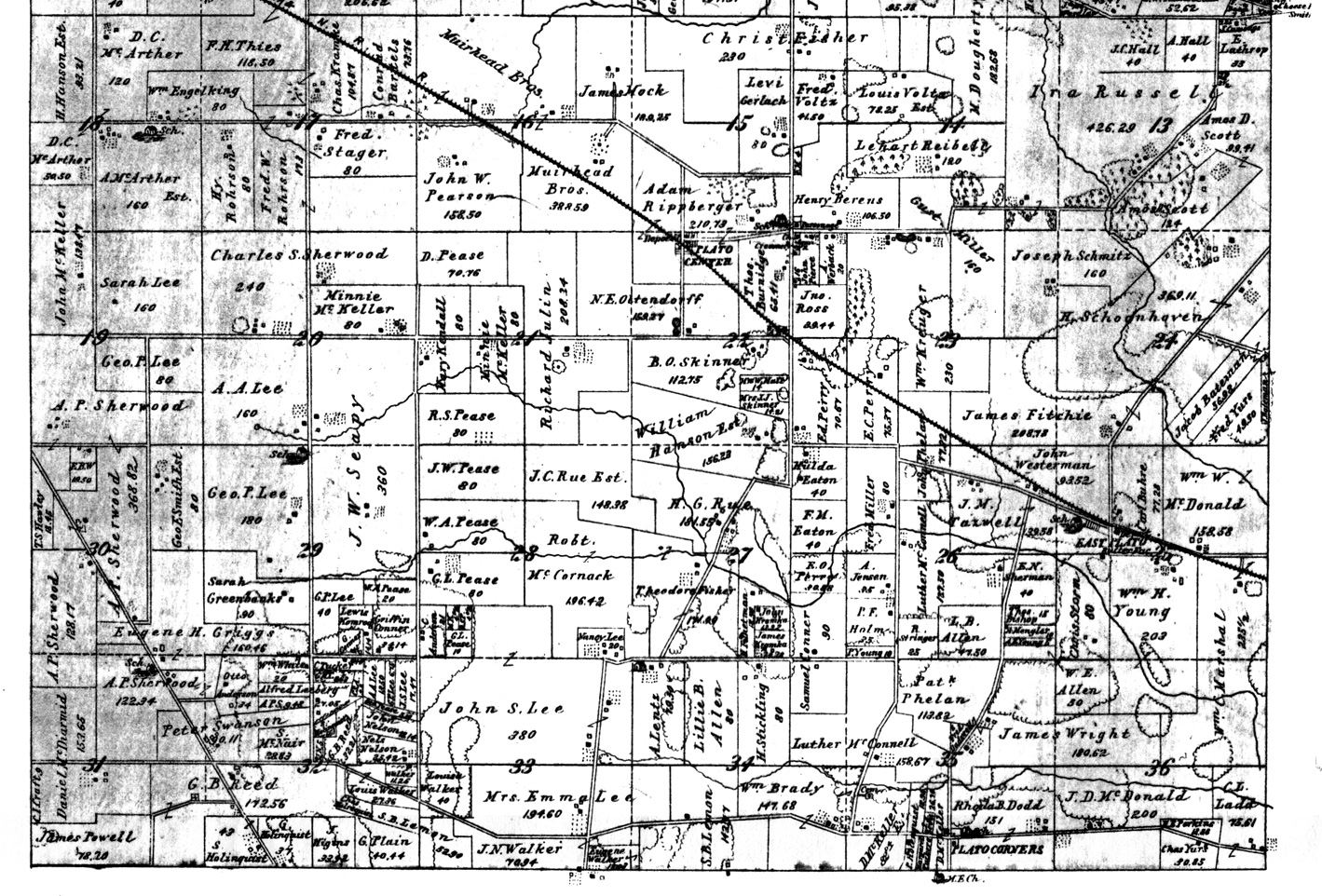
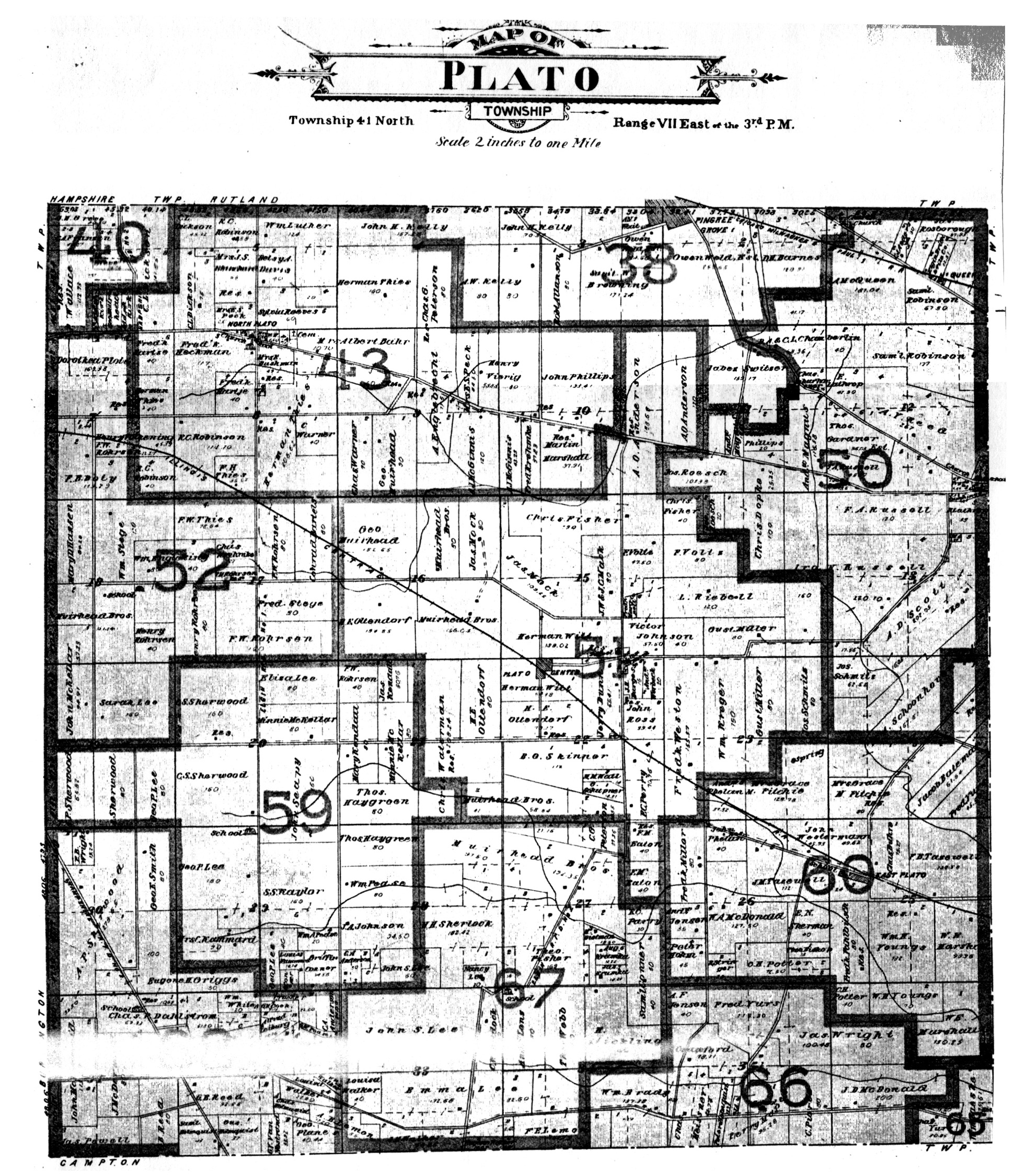
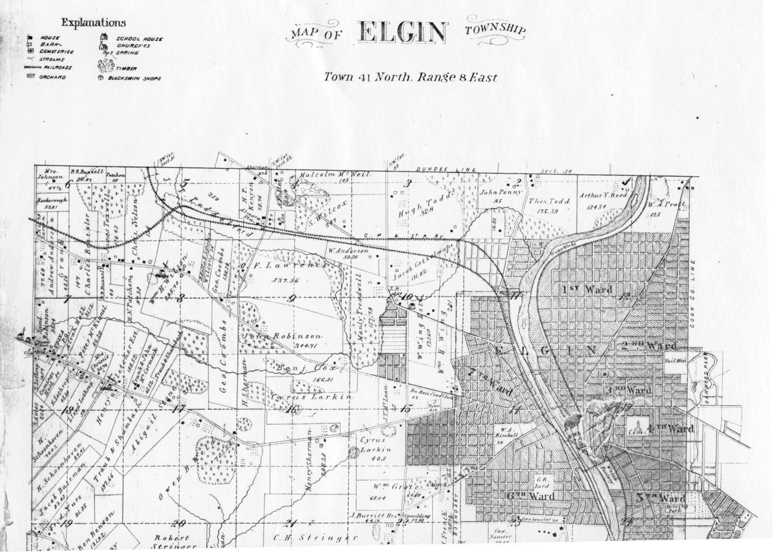
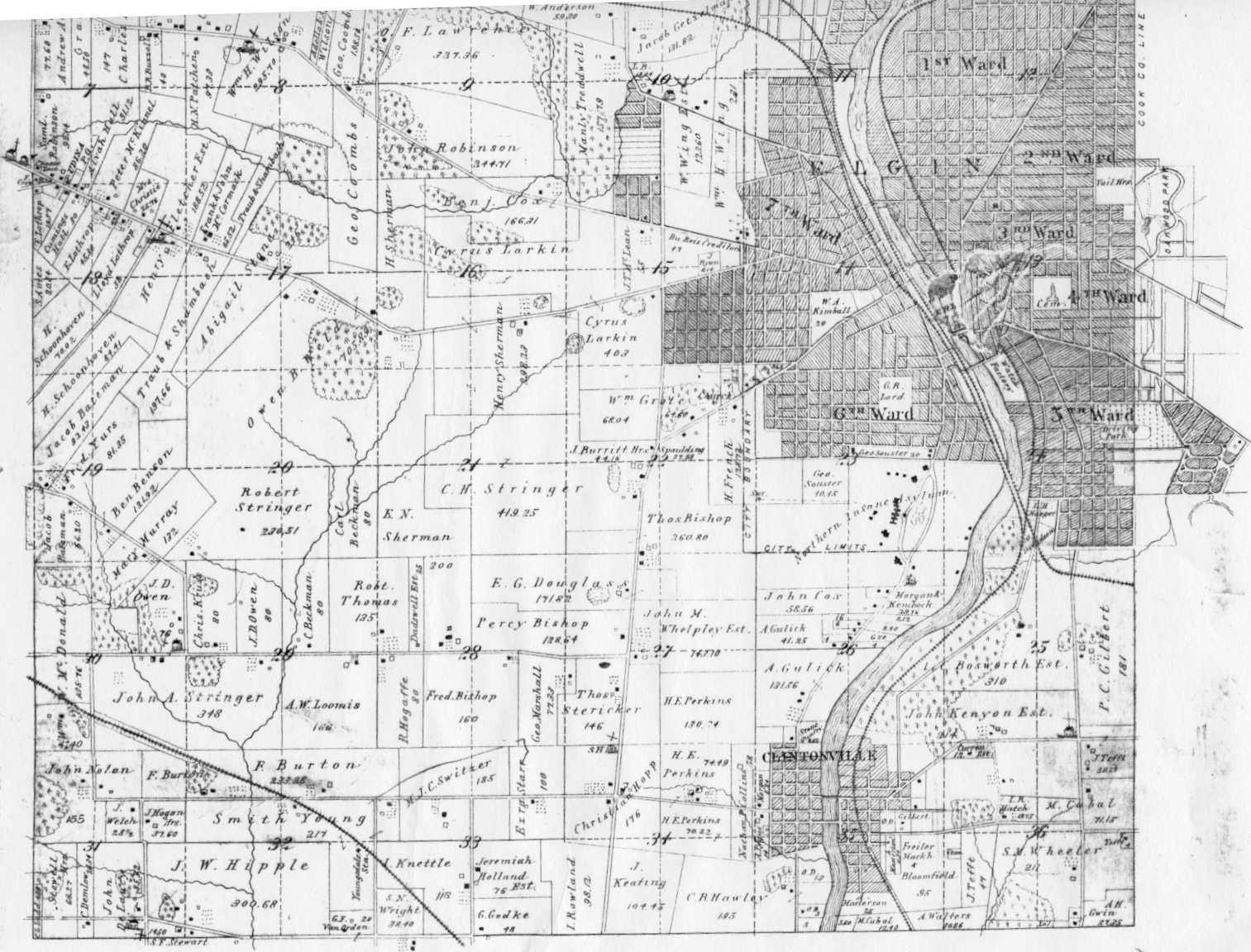
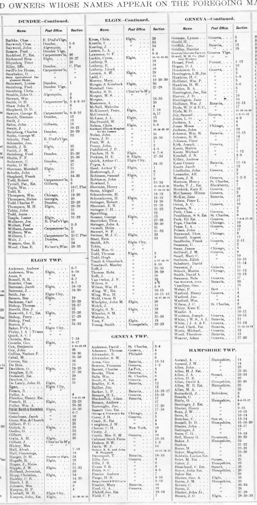
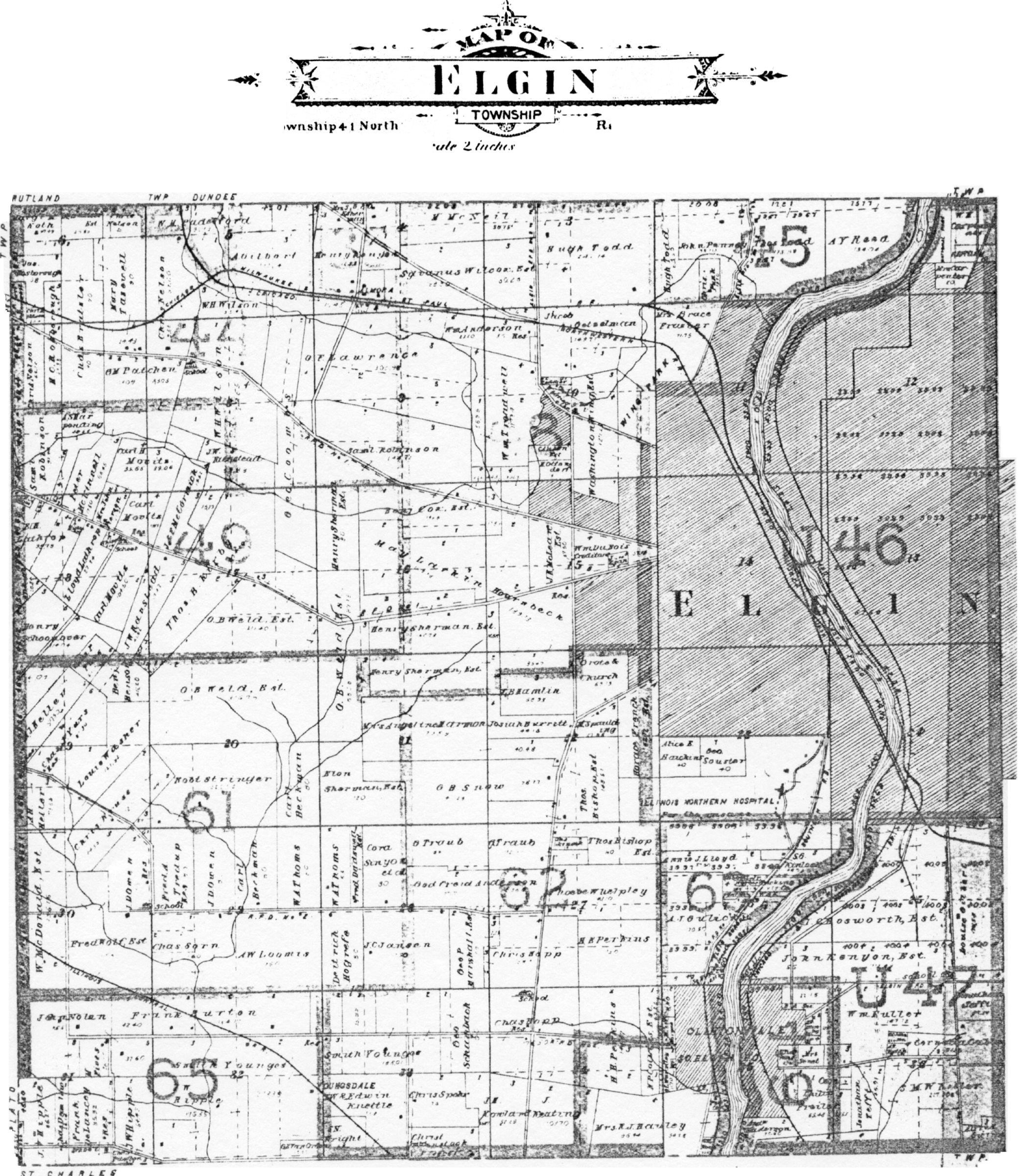
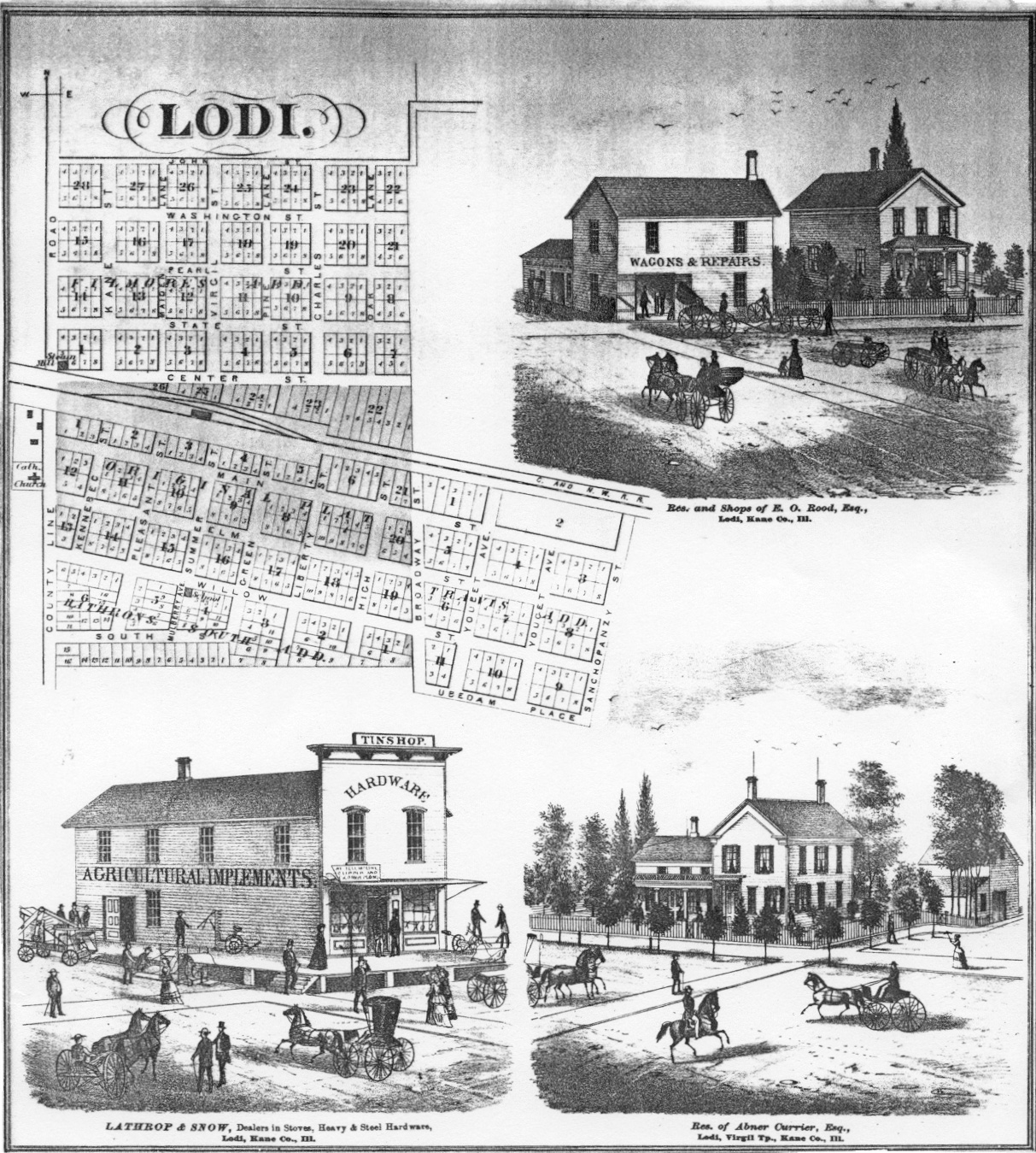
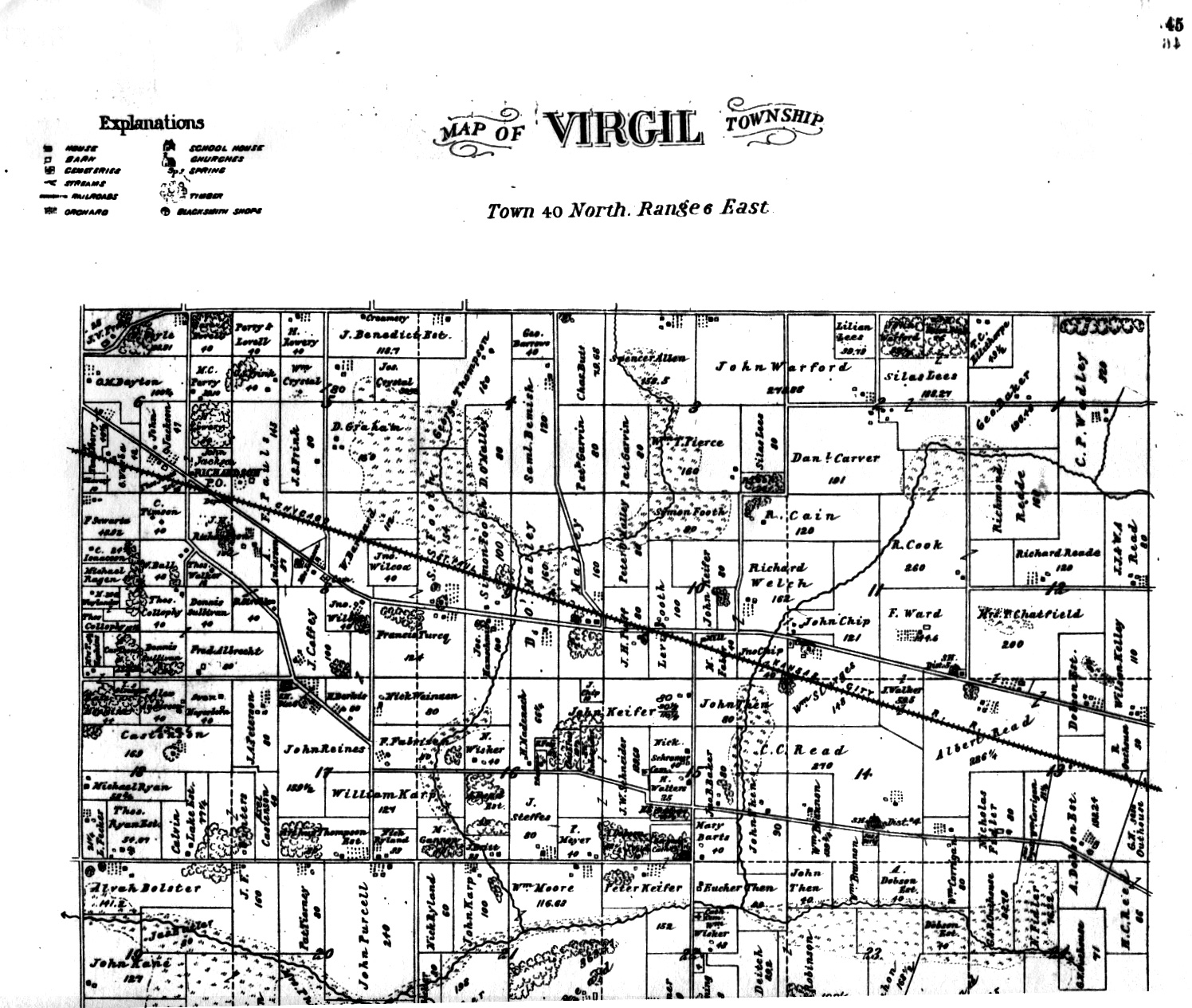
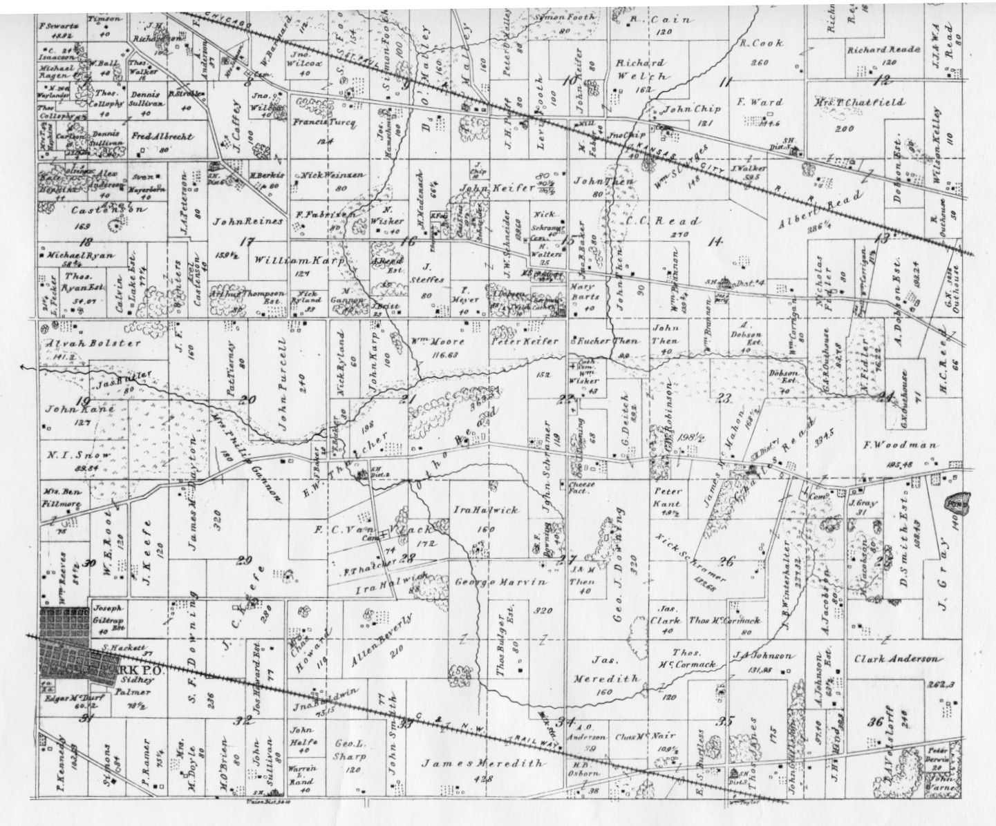
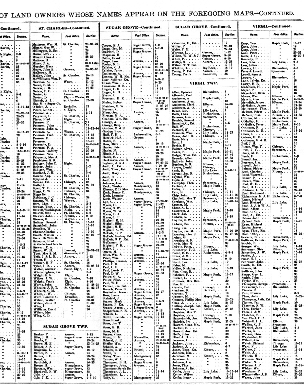
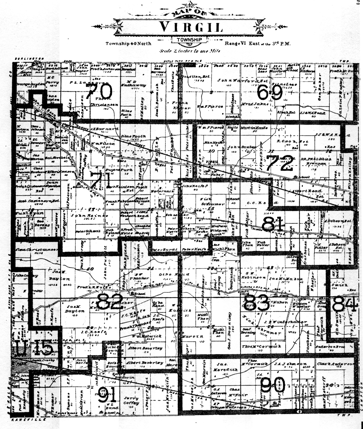
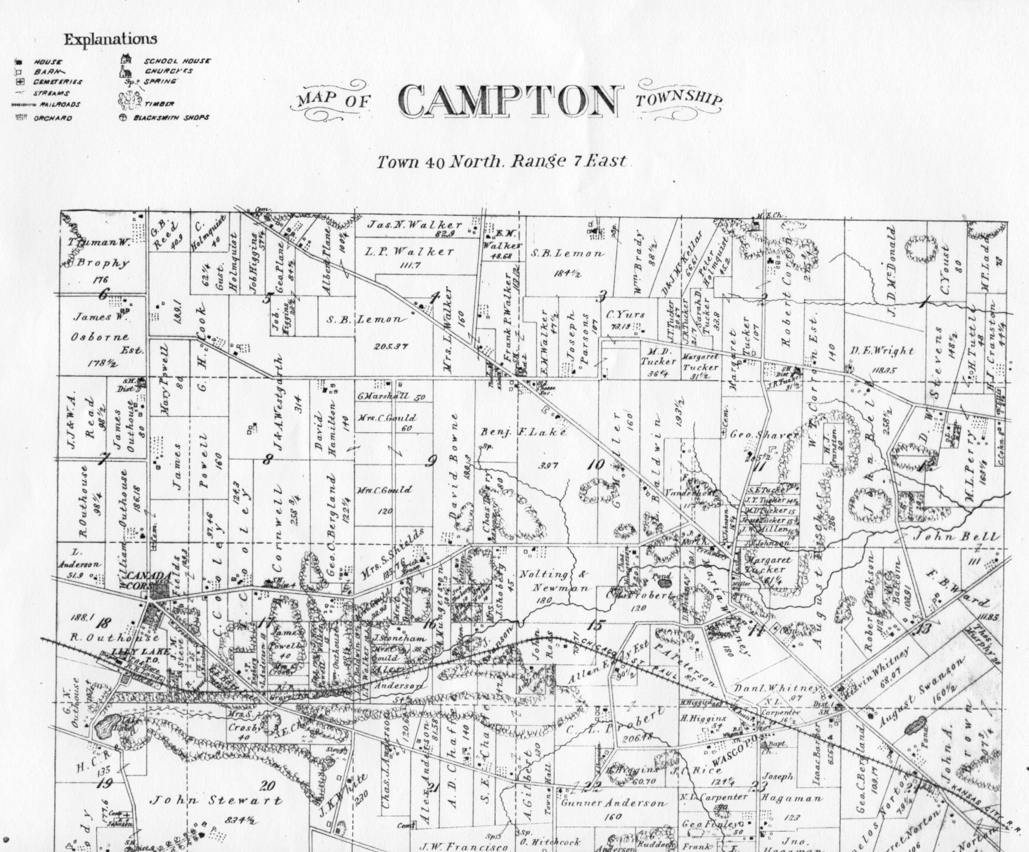
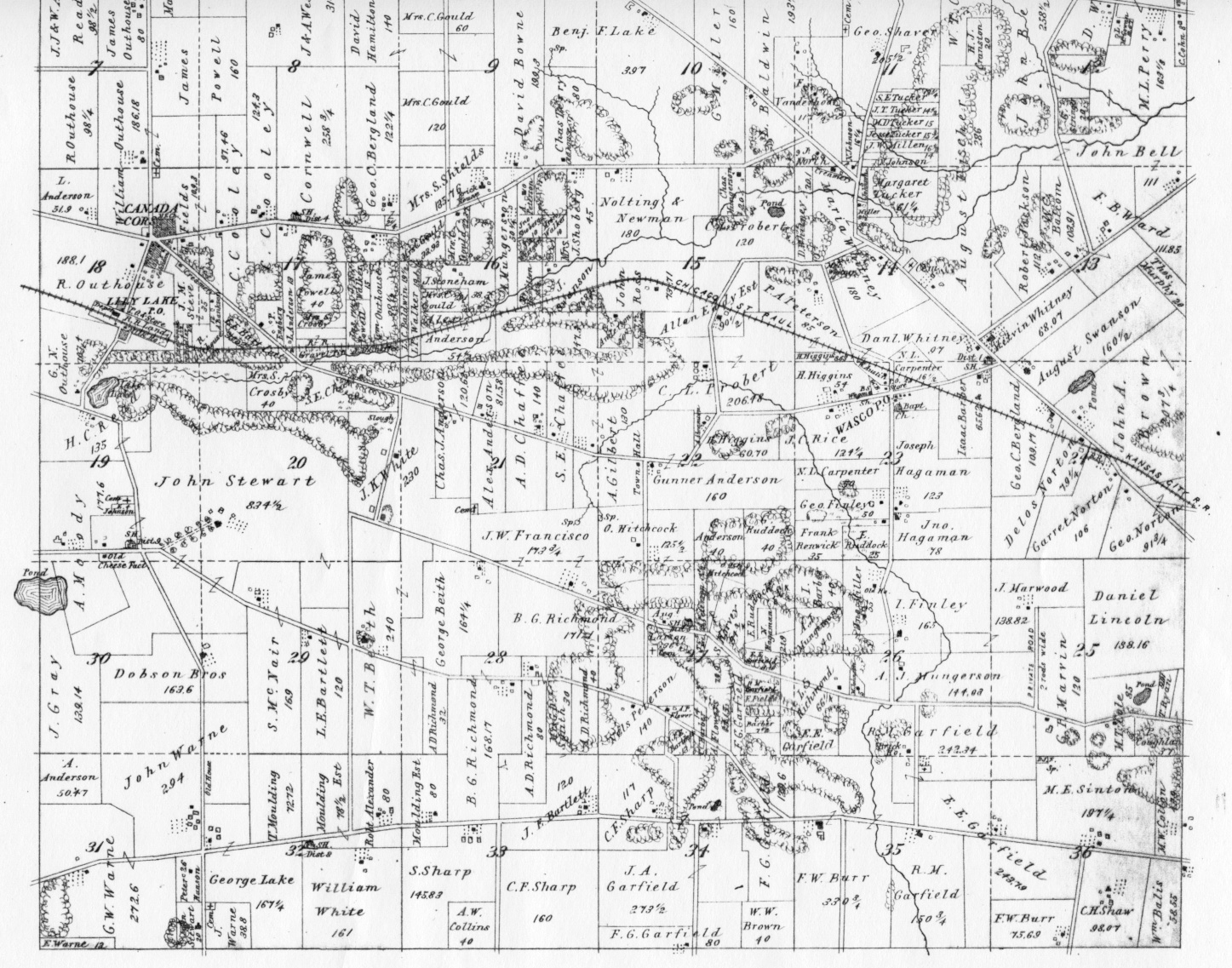
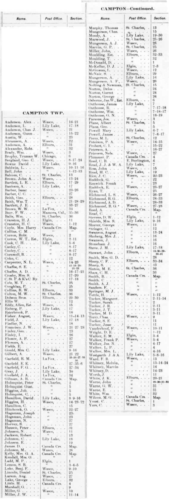
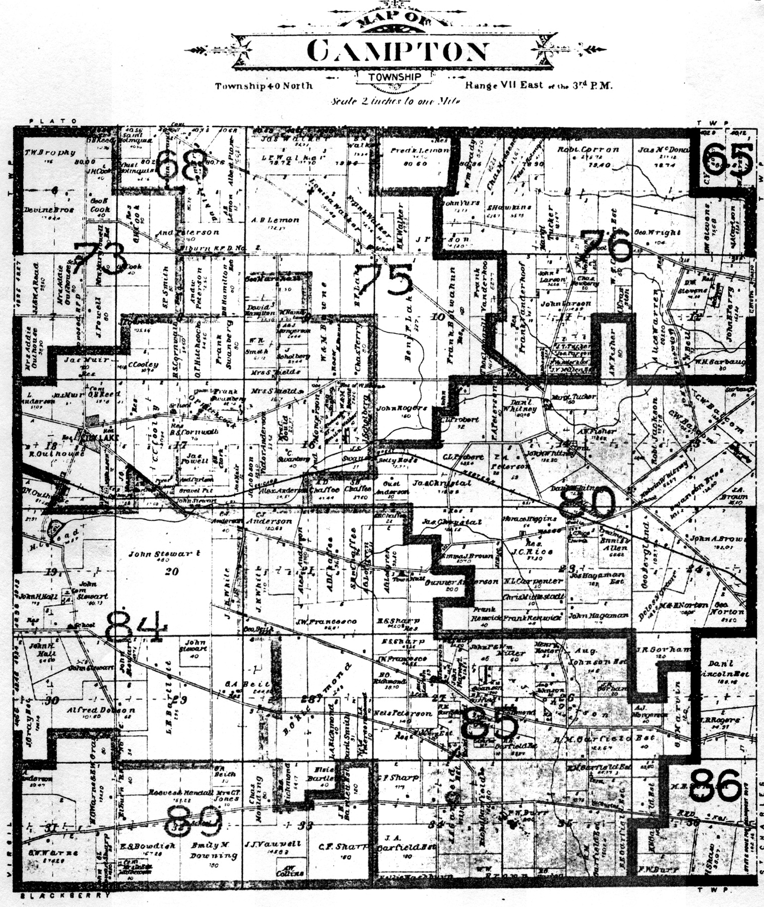
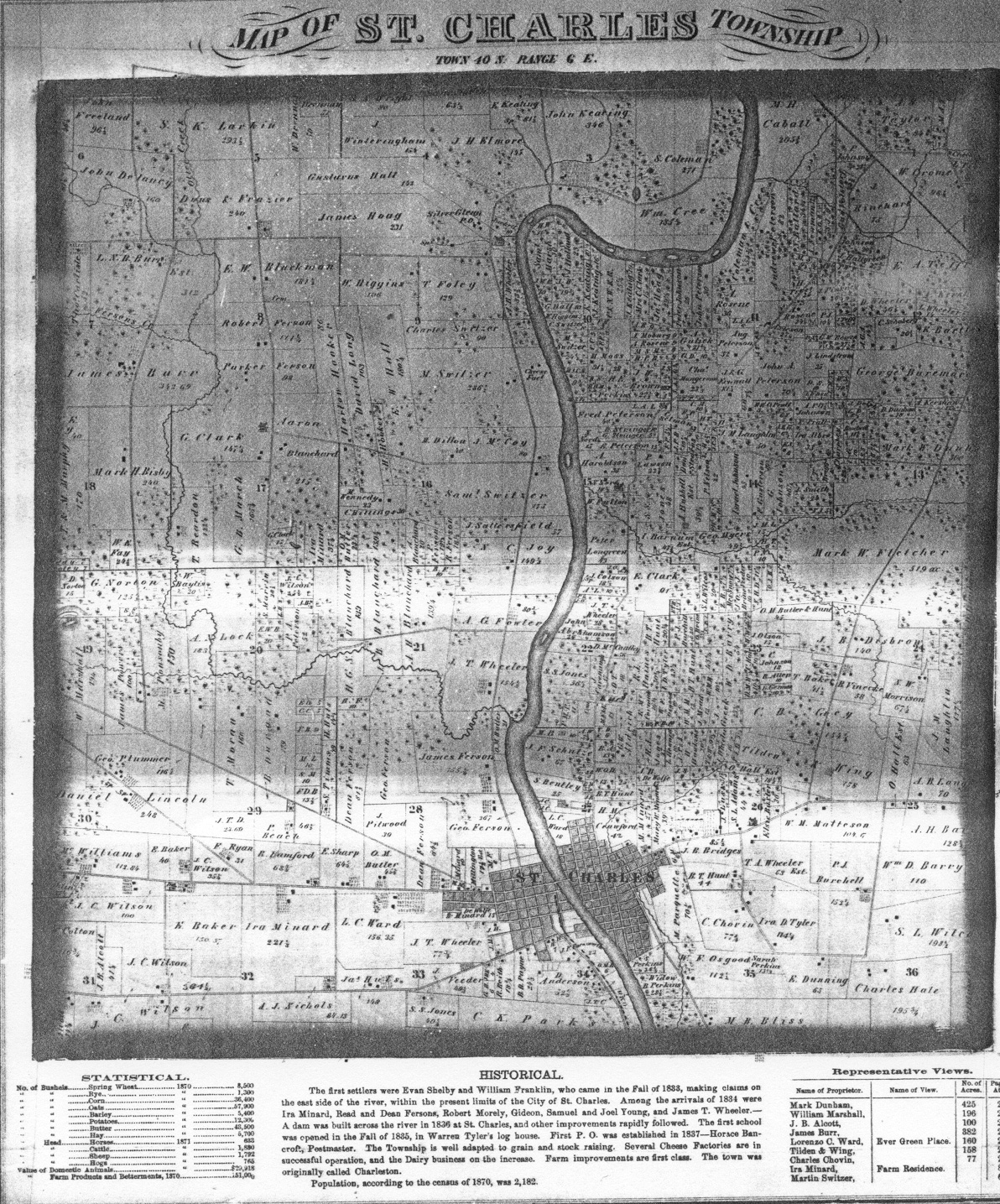
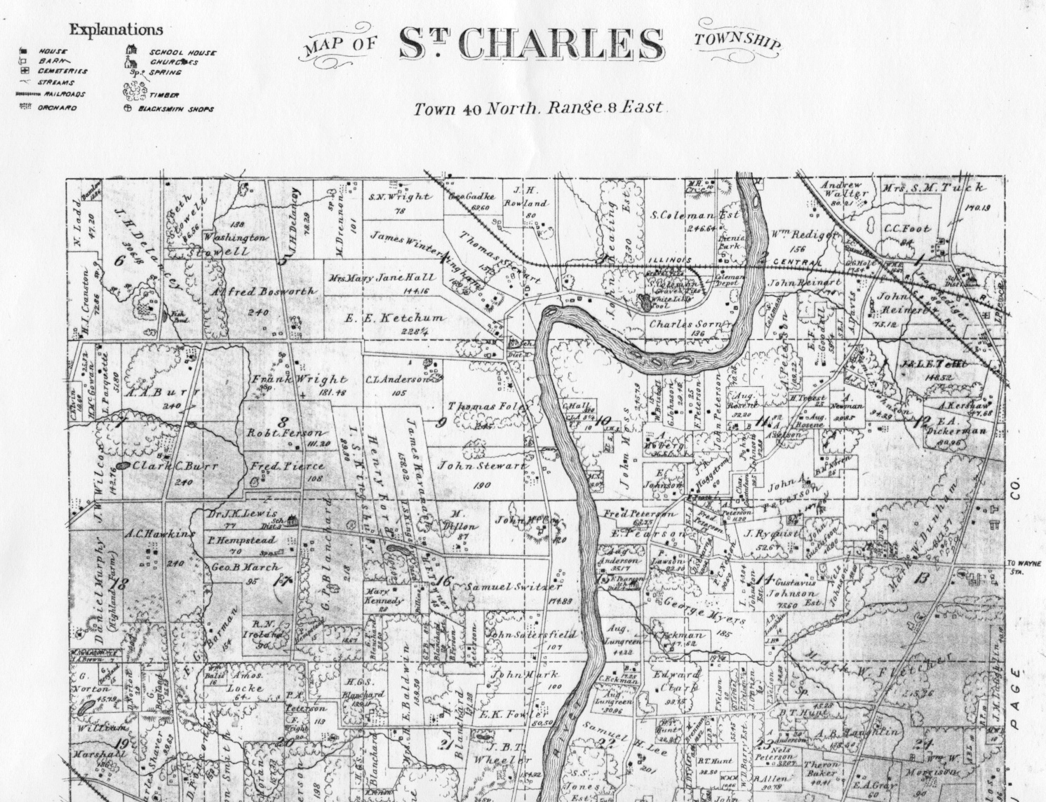
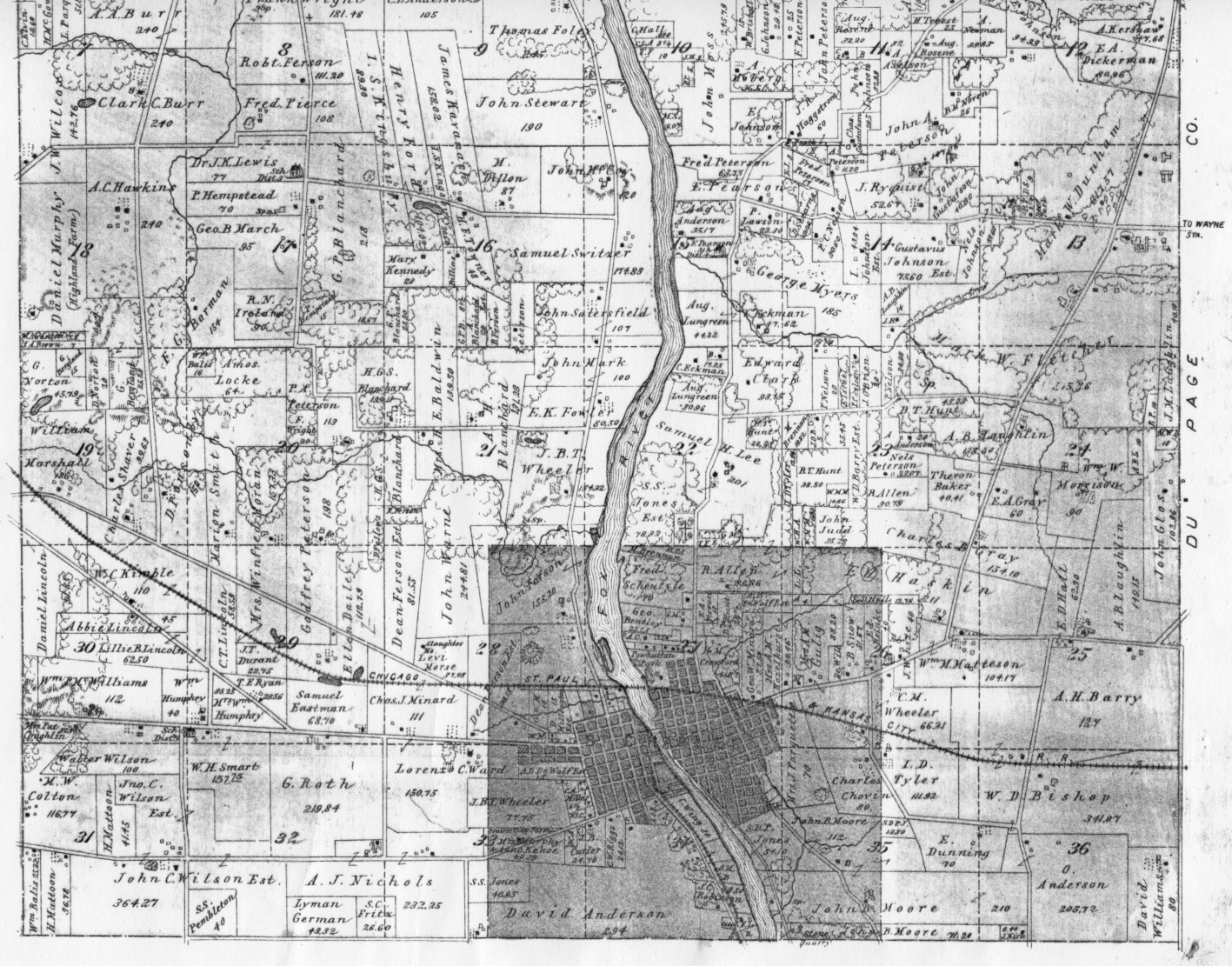
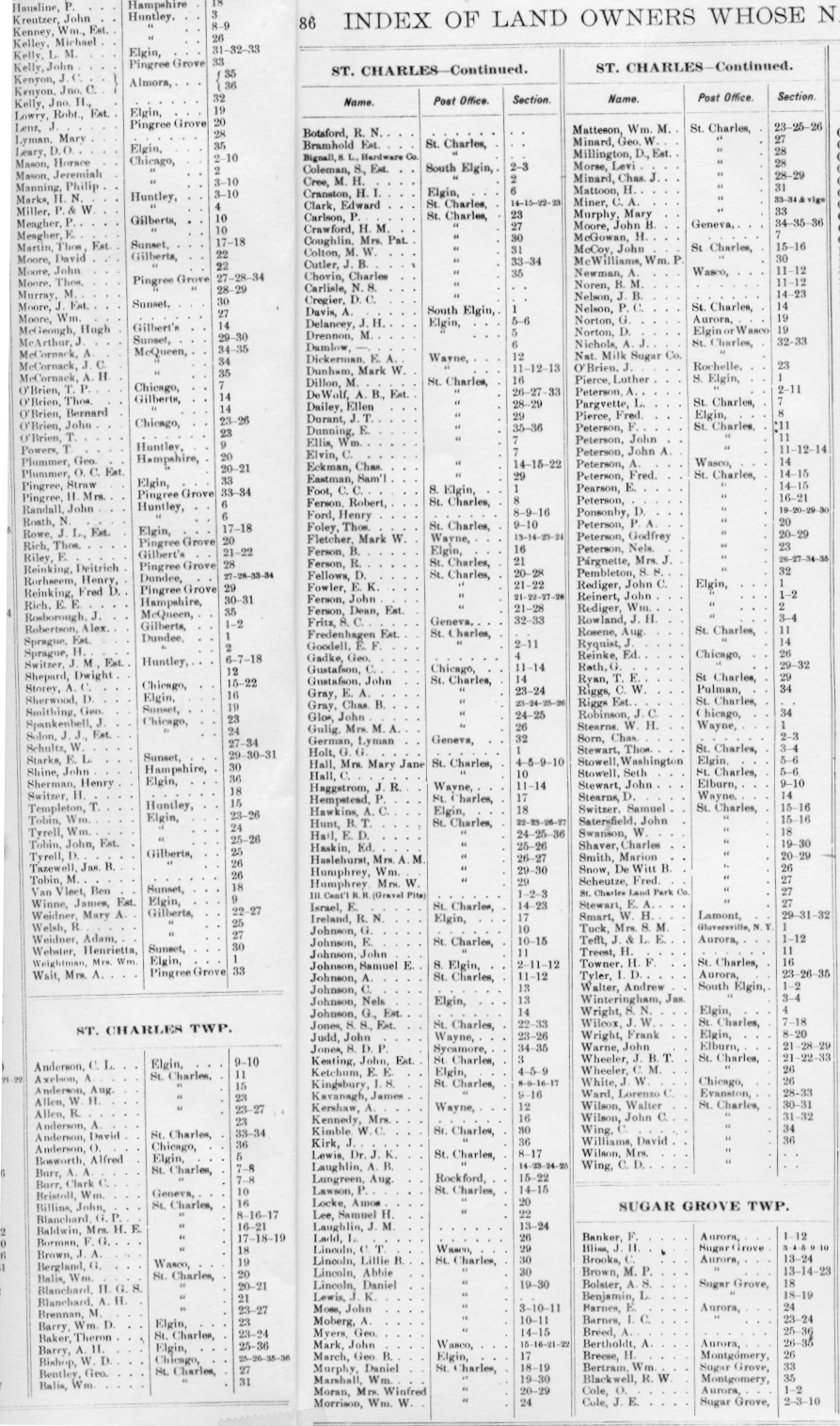
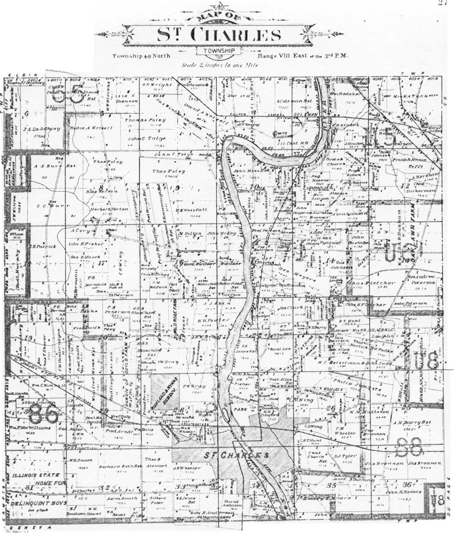
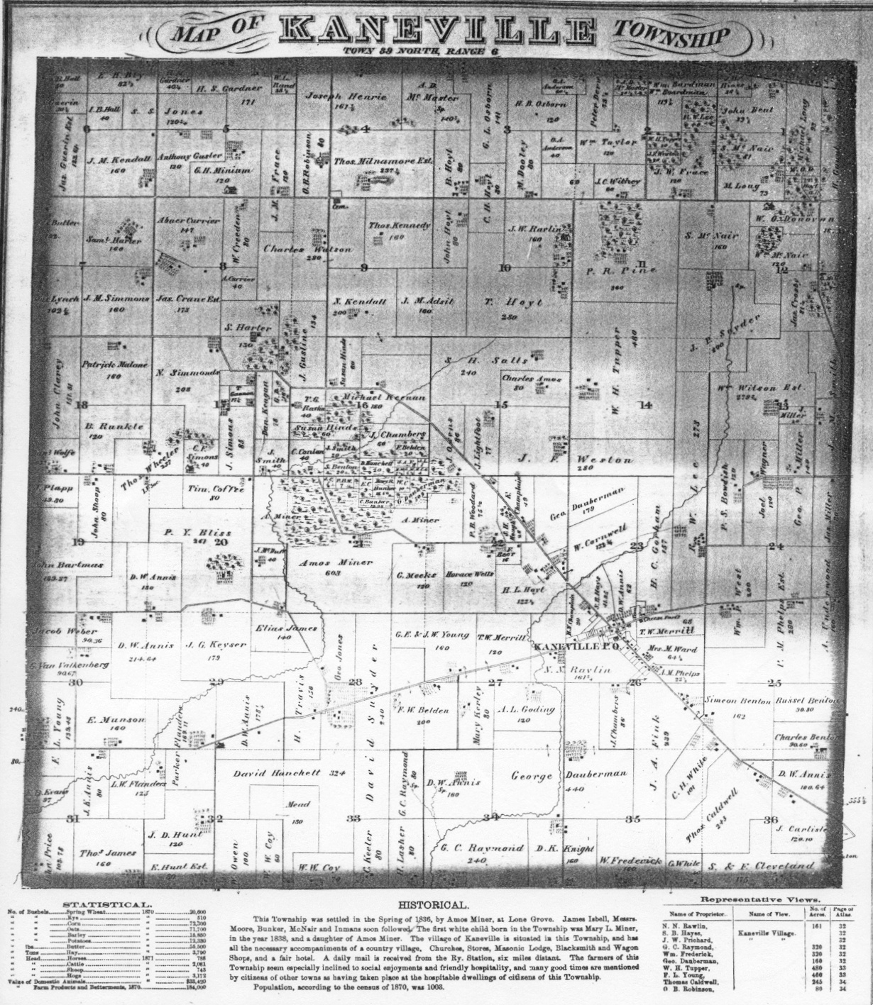
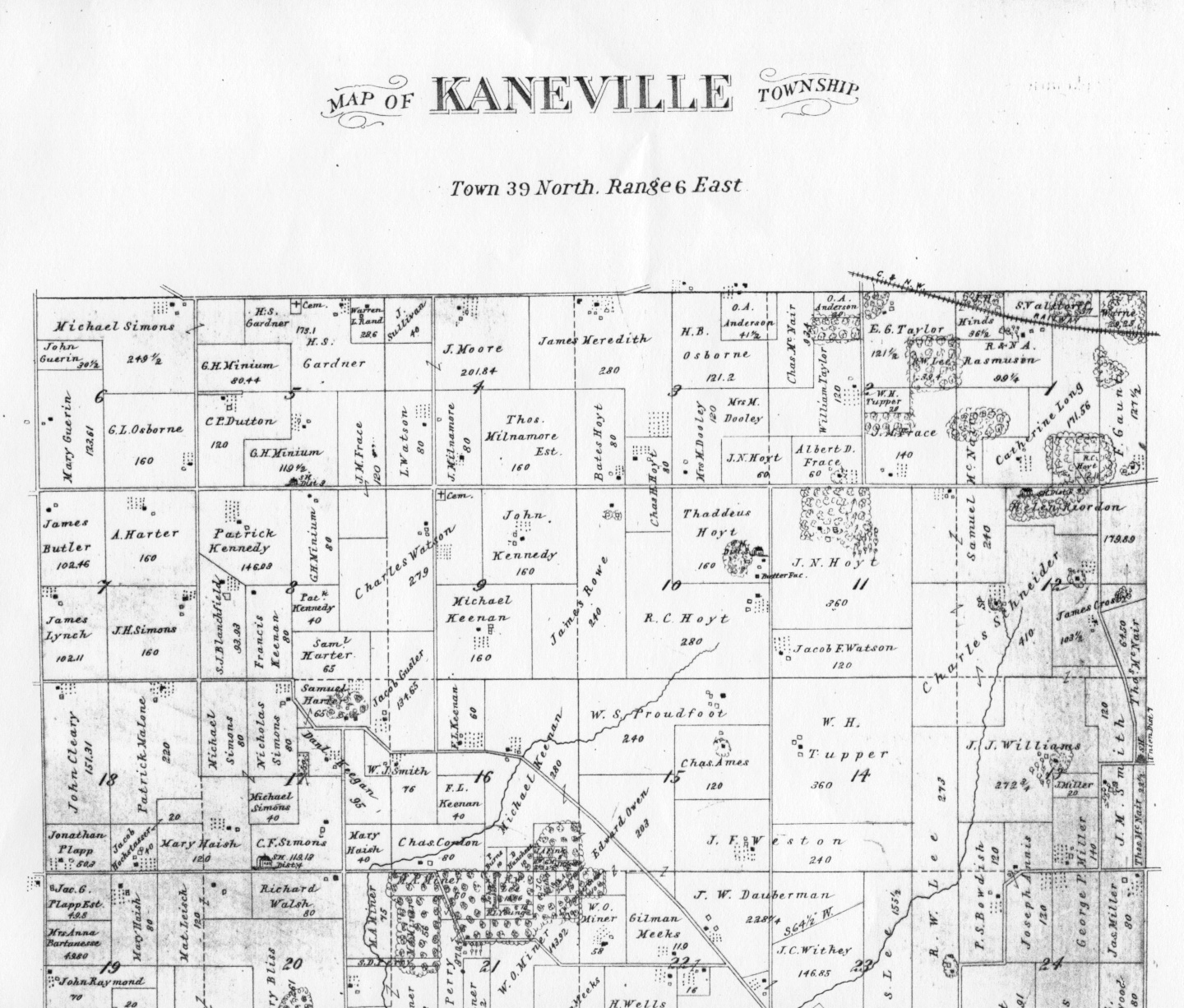
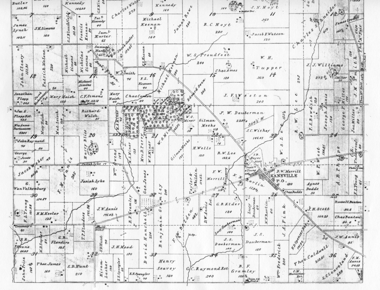
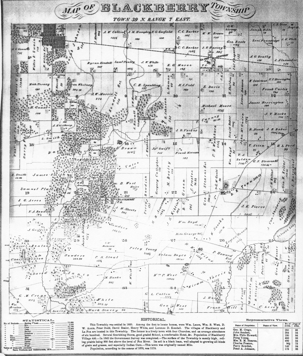
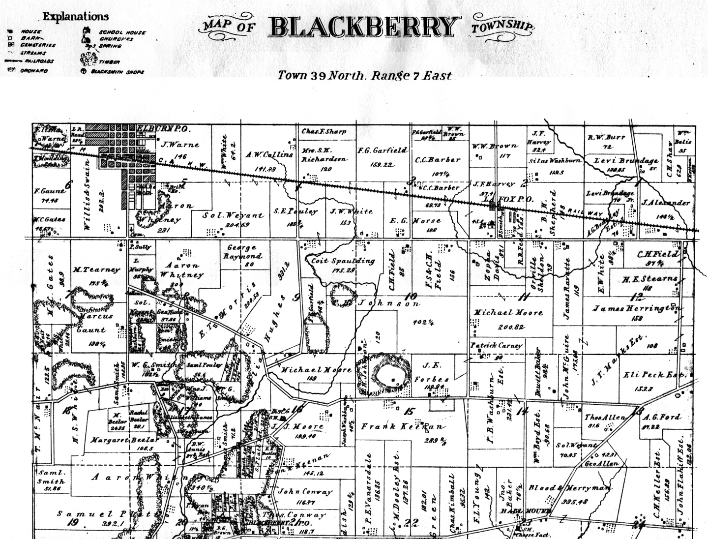
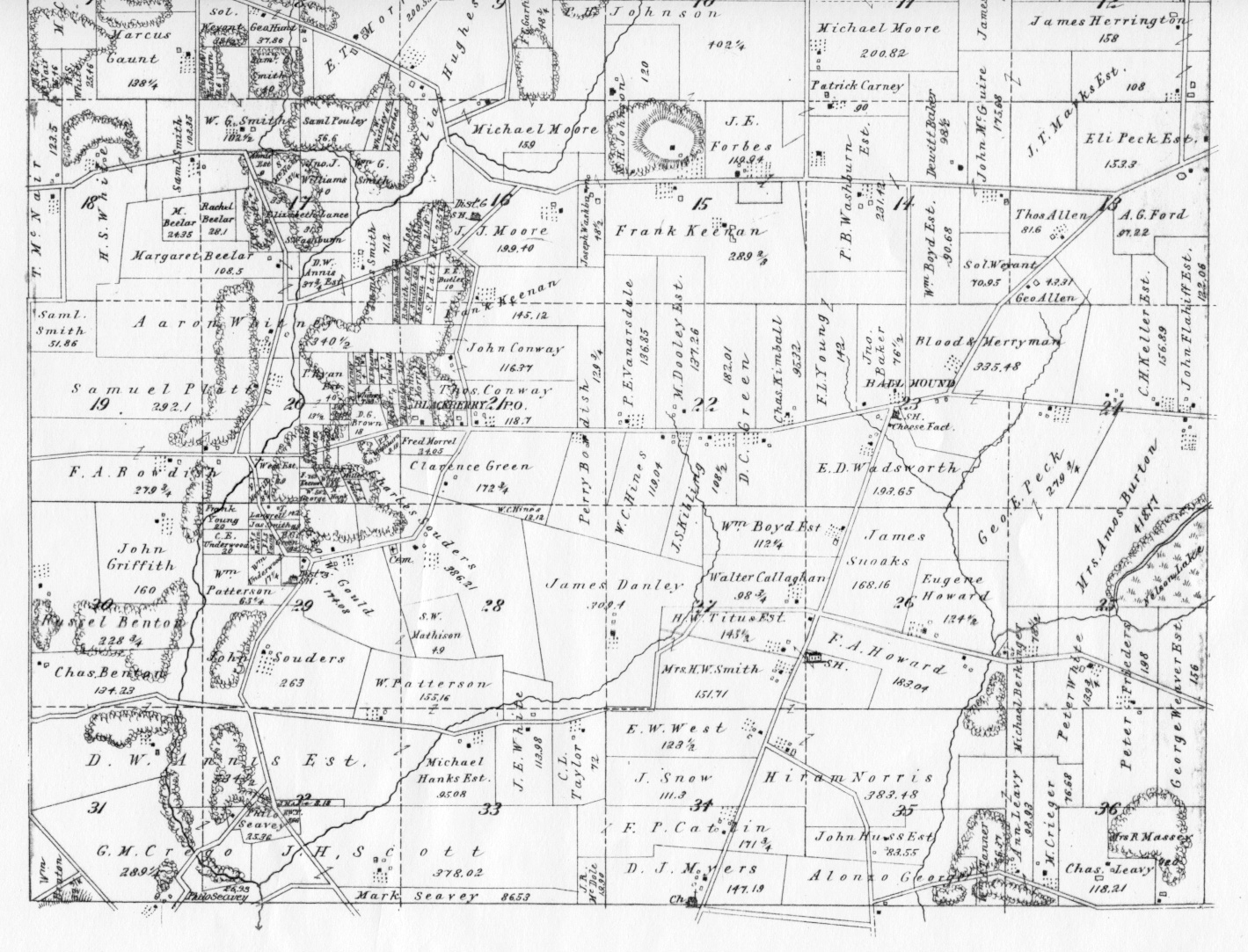
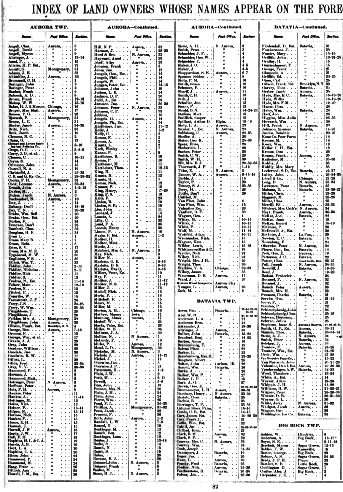
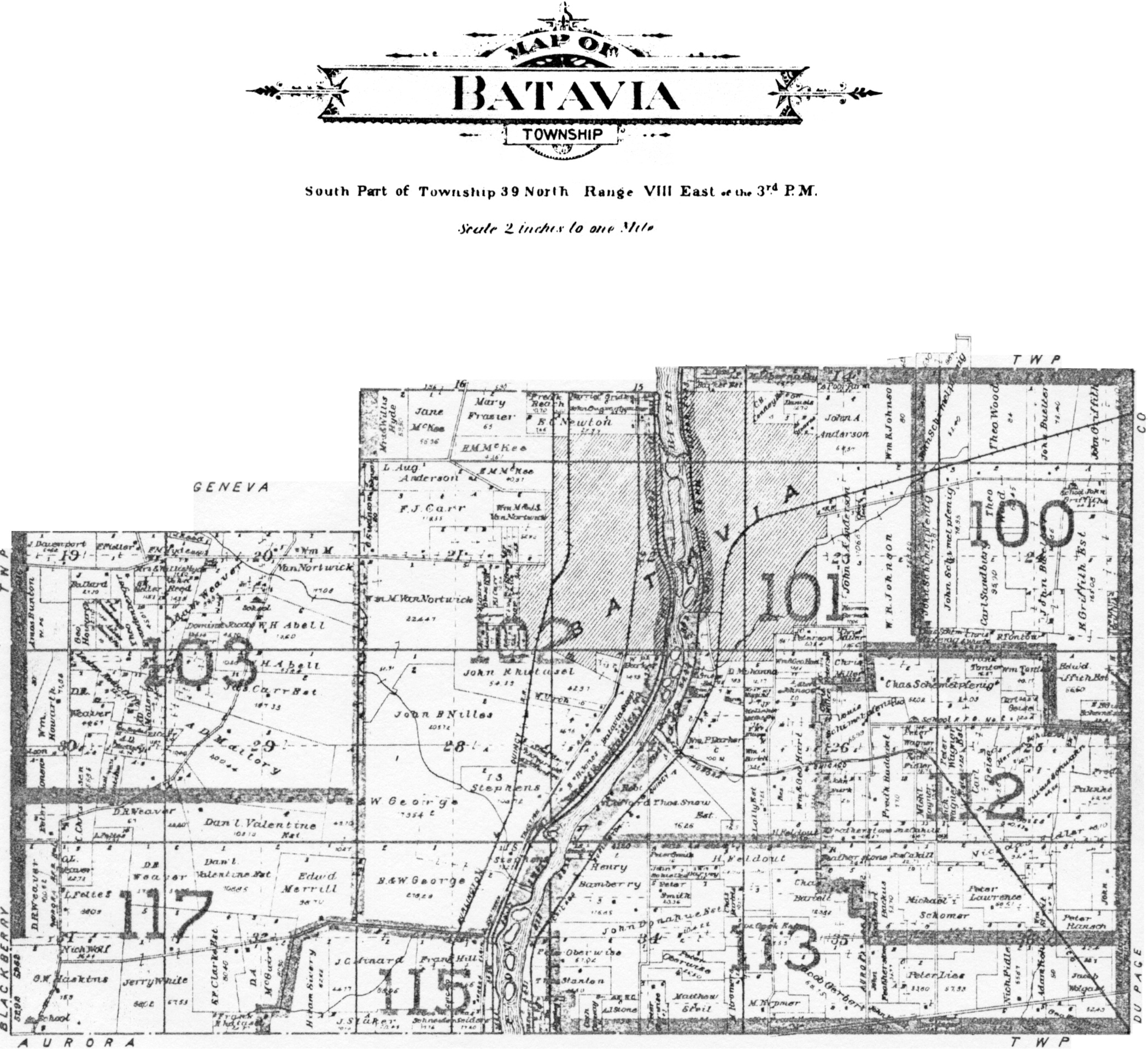
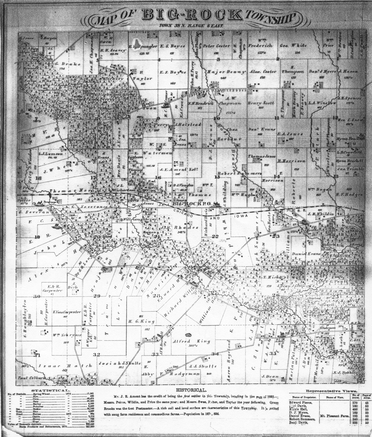
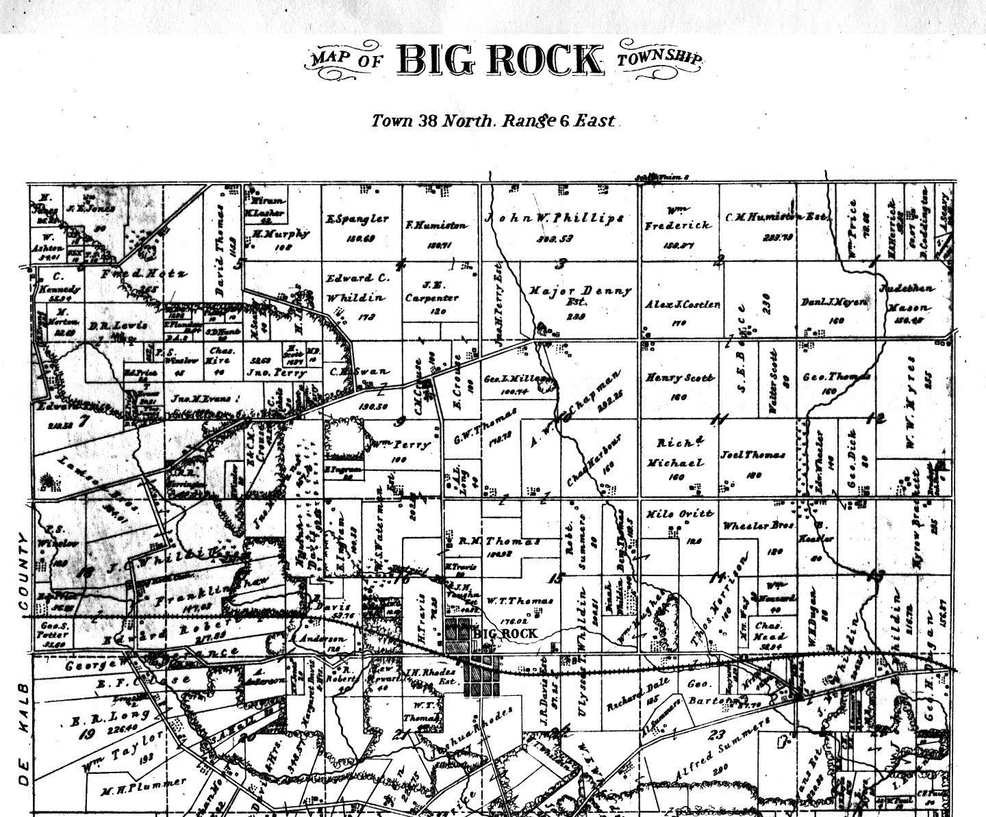
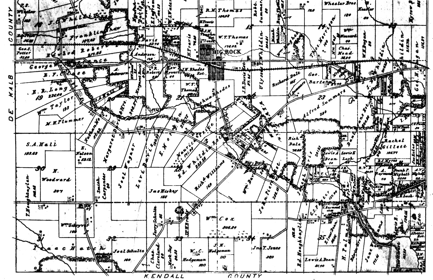
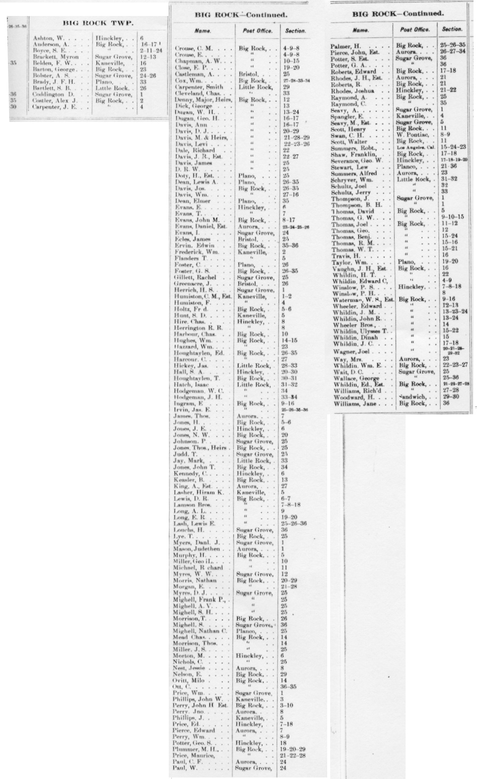
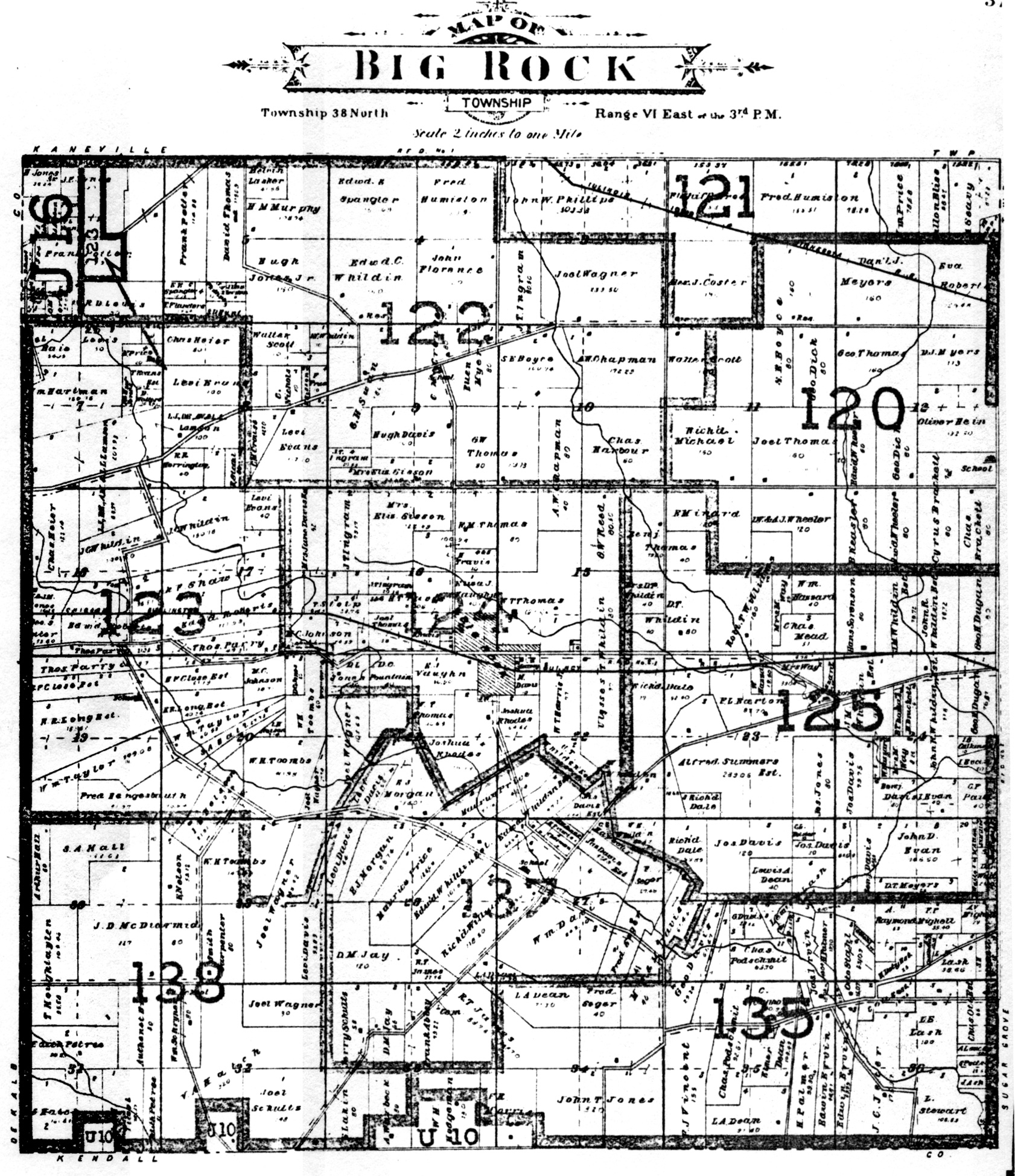
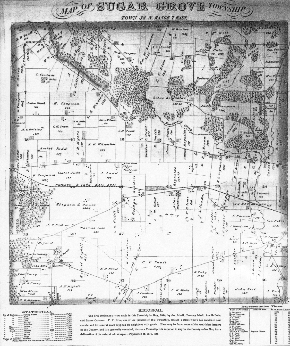
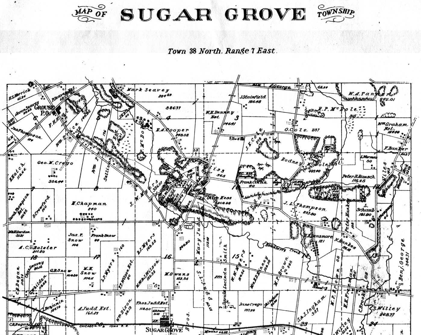
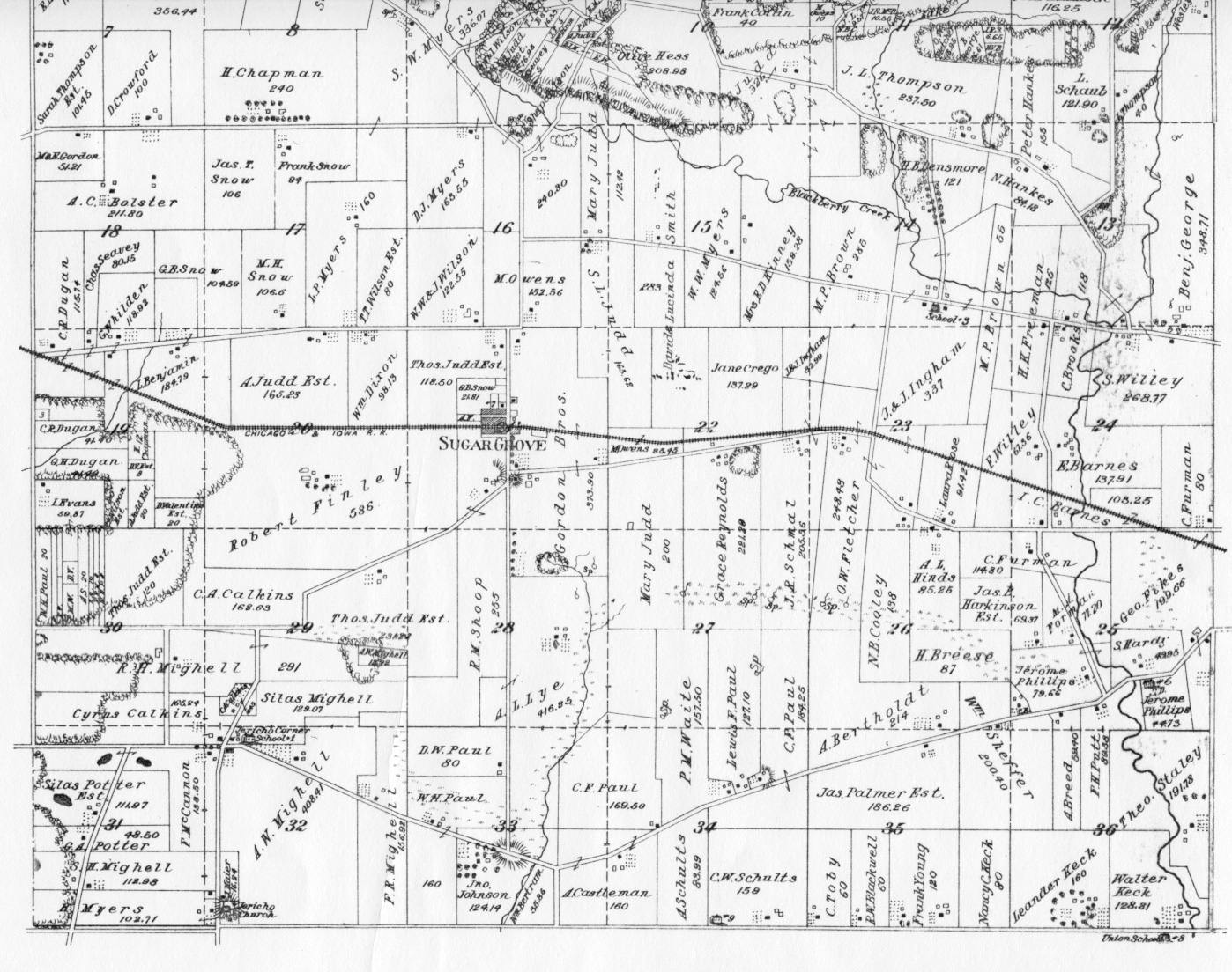
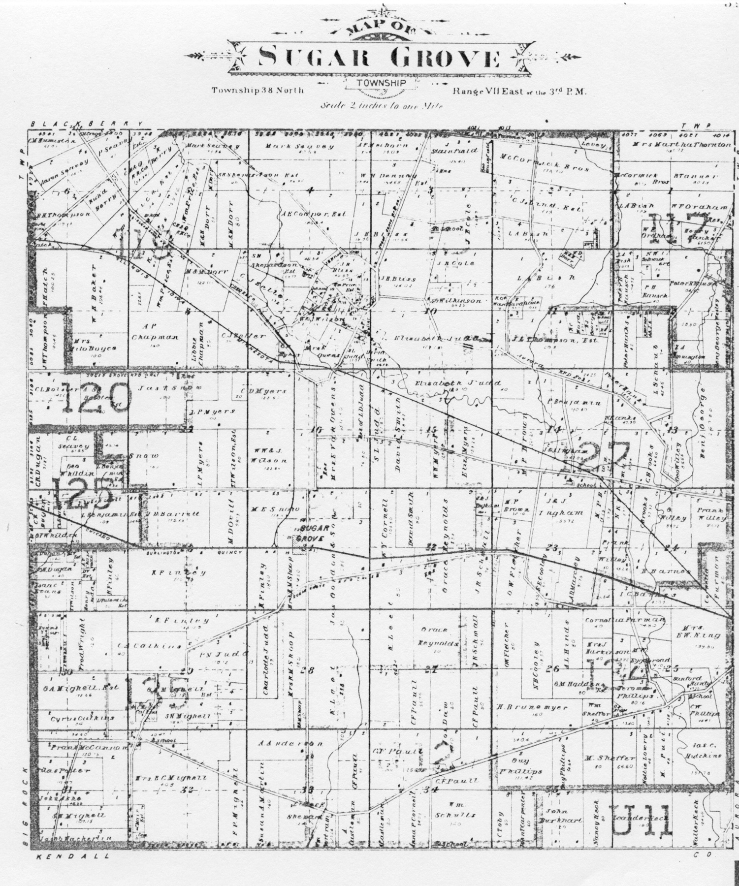
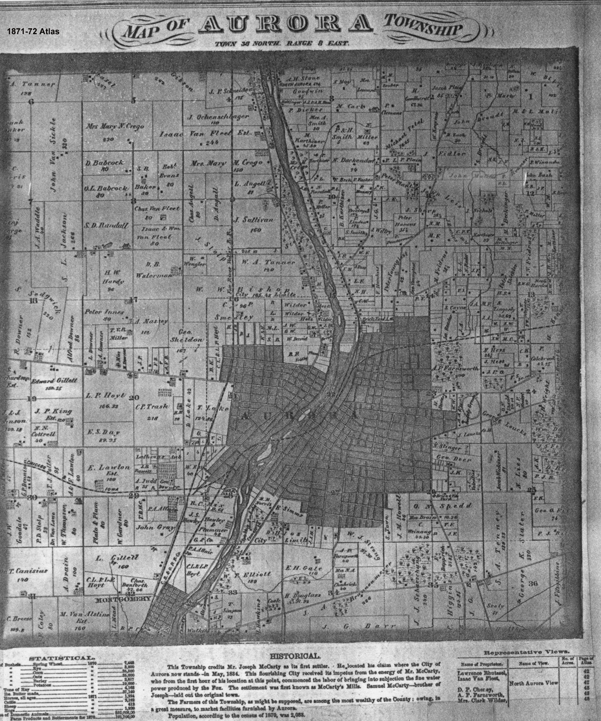
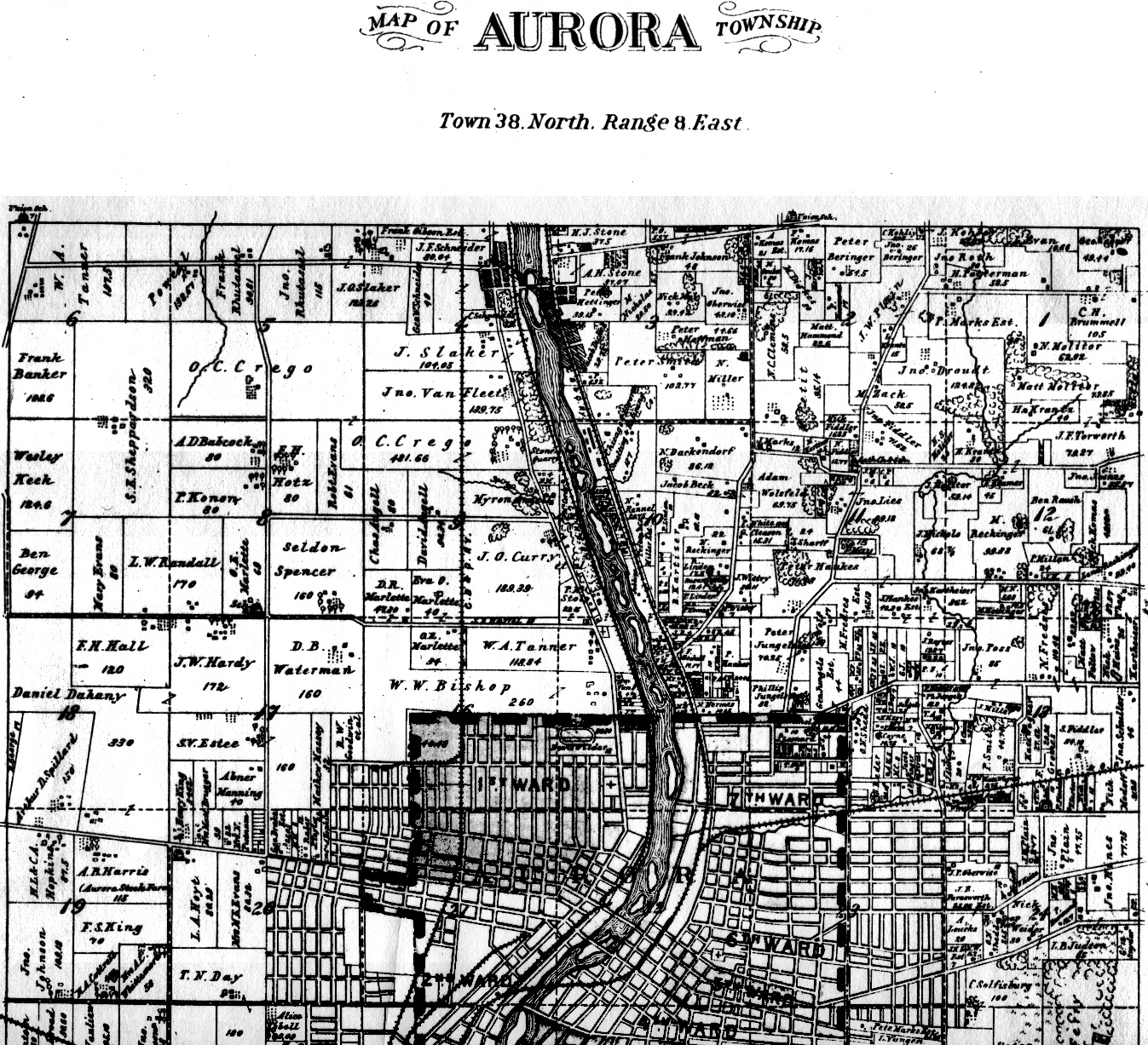
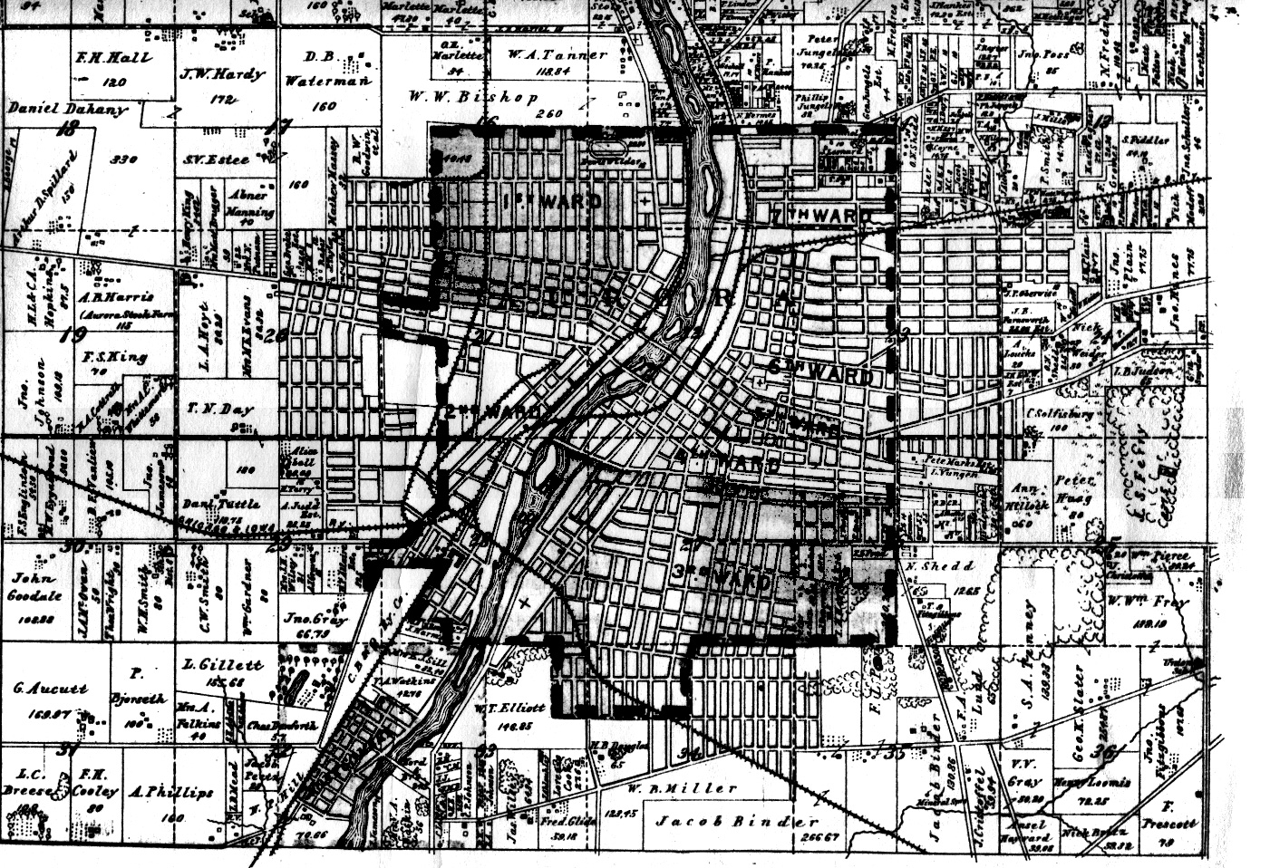
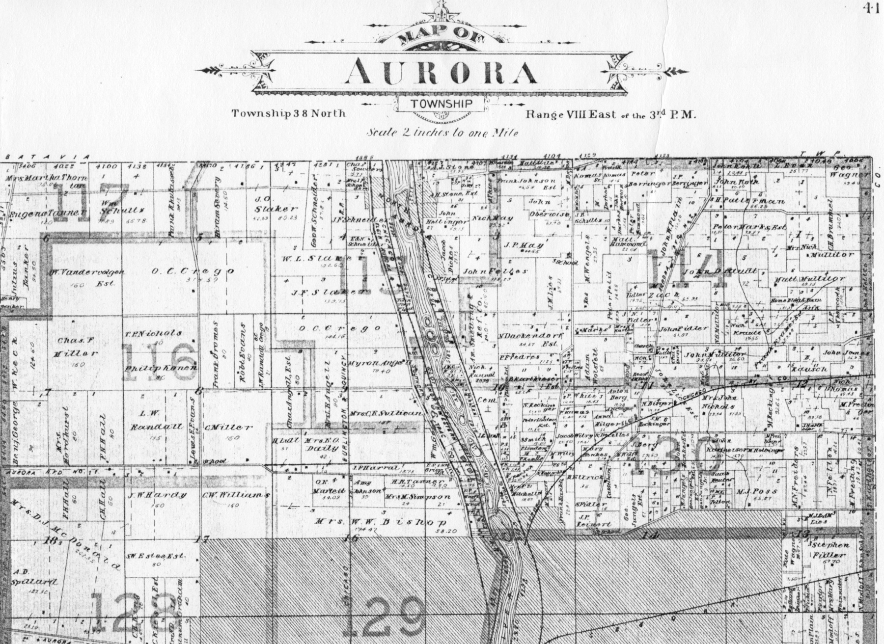
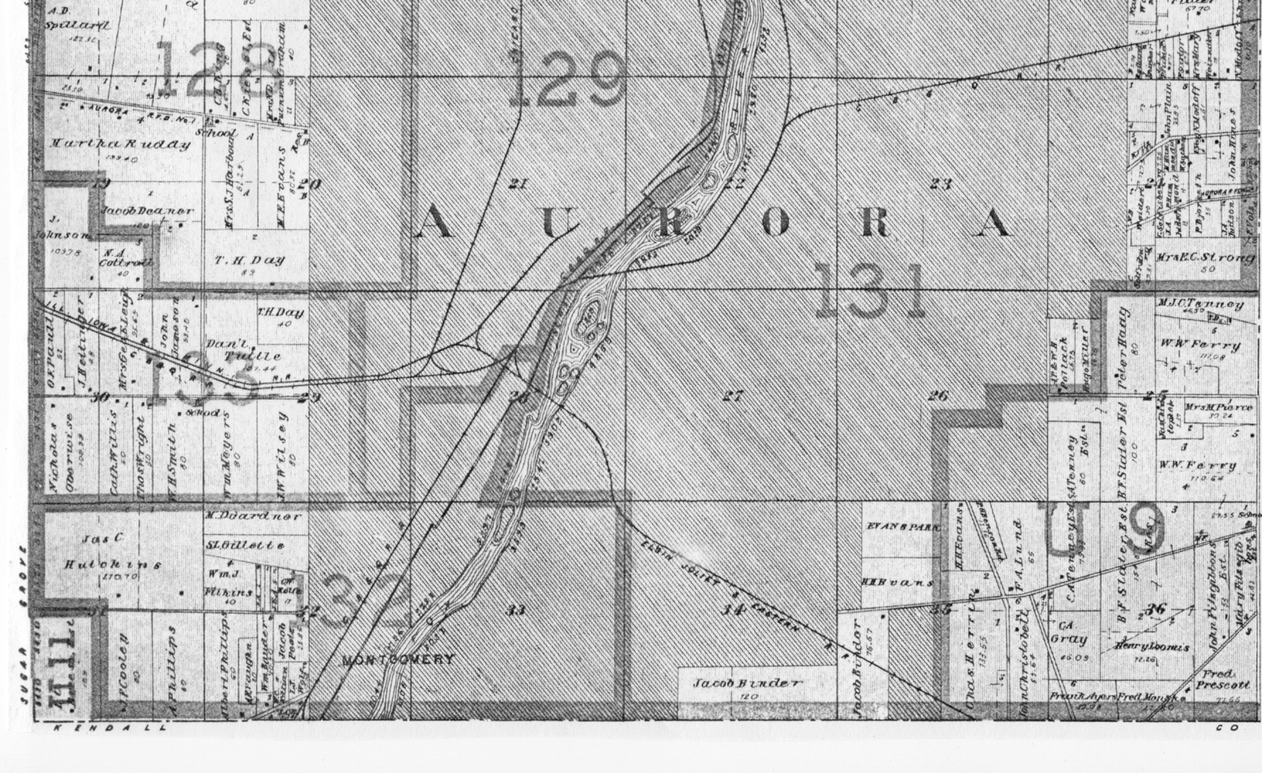
KANE COUNTY MAPS  COUNTY FORMATION & STATE CENSUS MAPS This link (outside of ILGenWeb) will show you how the counties changed through the years and census divisions for federal census years.Illinois Census and County Formation Maps . Visit Michael L. Hébert's excellent history of the Illinois county formations at http://maps.ilgw.org/ HISTORICAL COUNTY TOWNSHIP MAPS Janet Pearson has copied township maps from atlases from different years. As they become available, they will be added to the list. To see a map of a particular township, click on the year within that township. These maps can be exciting sources for research as they show the property owners at the time the map was compiled - between census years. Sources: 1872 - Combination Atlas Map of Kane County Illinois. Compiled, Drawn and Published from personal Examinations and Surveys by Thompson and Everts, Geneva, Illinois, 1872. See the title page from this atlas. These maps were scanned and contributed by Janet Pearson.1875 Map of Kane County showing all Townships Donated by Alice Gless from the Atlas of Henry Co. IL to Which is Added an Atlas of the United States" by Warner & Beers Publishers, Chicago. 1892 -
Atlas of Kane County Illinois. Drawn and Compiled
from Personal Observations, Actual Surveys and
County Records. D. W. Ensign & Co. 1892 See
the title page
from this atlas. County "overview" maps showing
the townships and section numbers can be viewed
for the north
and south
portions of the county. This set of maps have been
scanned and donated by Janet Pearson. 1904 -
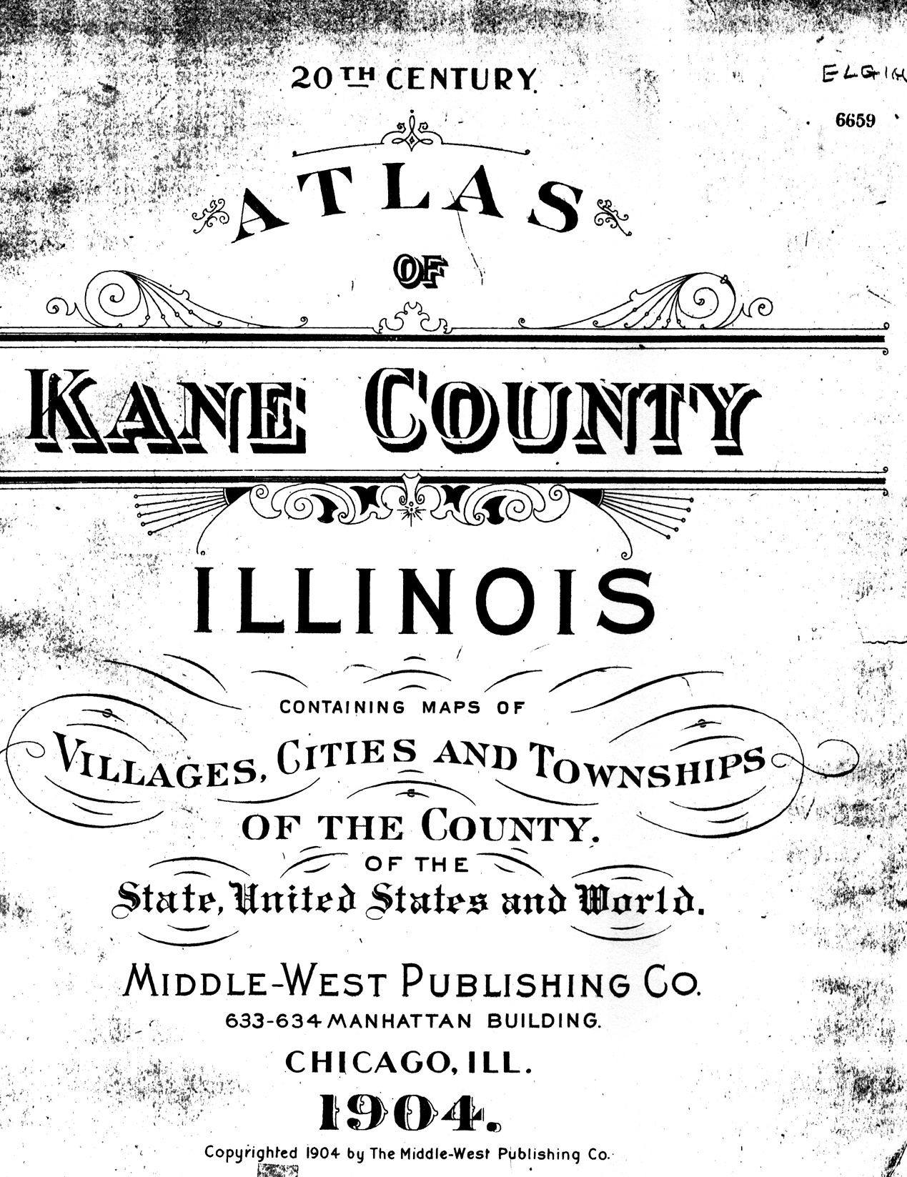
20th Century Atlas of Kane County Illinois,
Containing maps of Villages, Cities and Townships
of the County. Middle-West Publishing Co. 633-634
Manhattan Building, Chicago, ILL. 1904. See the title page
from this atlas. This set of maps were scanned and
donated by Janet Pearson.
ILGenWeb Project Sandy Bauer, State Coordinator The USGenWeb Project consists of a group
of volunteers working together to provide Internet
websites for genealogical research in every county
and every state of the United States. The Project is
non-commercial and fully committed to free access
for everyone.
Contact Kane County ILGenWeb Coordinator Contact: IlGenWeb State Coordinator Please put "Kane County" in your subject line.Many thanks to Patricia "Pat" Sabin (2008-2022) and Marcia Holpuch for their leadership as County Coordinators (1998-2007). Copyright by the IllinoisGenWeb Project |